Norfolk Coast Path - Heacham to Brancaster
|
Thursday 24 February 2022
|
No comments |
![]()

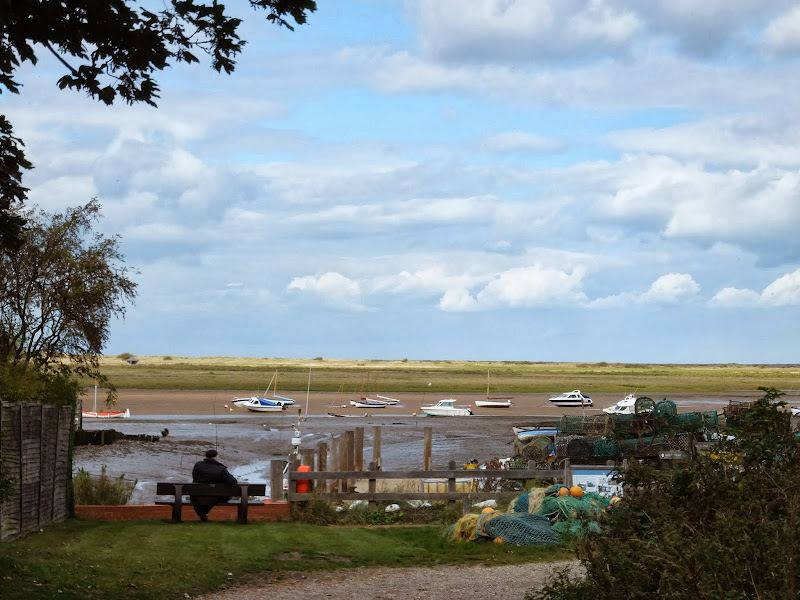
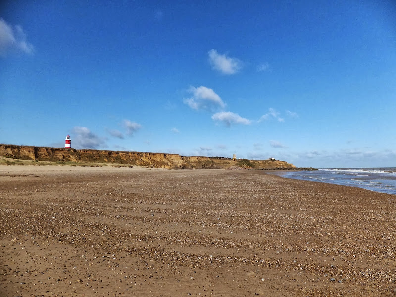
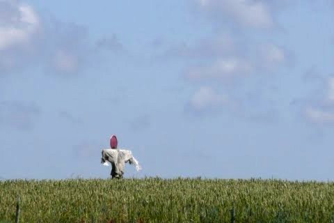
Heacham to Brancaster
A walk of beach, prom, dunes and marsh. A thoroughly varied landscape all told
|
Thursday 24 February 2022
|
No comments |
![]()
A walk of beach, prom, dunes and marsh. A thoroughly varied landscape all told
|
Tuesday 24 December 2019
|
No comments |
![]()
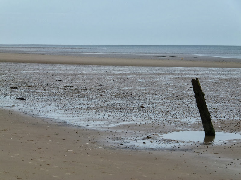
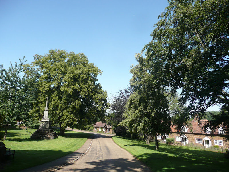
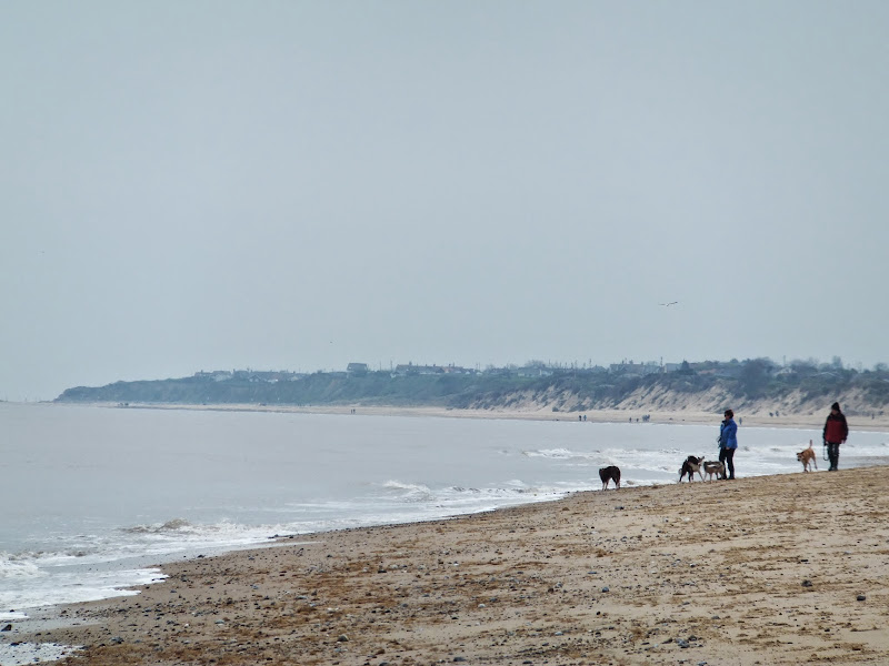
A 7 mile walk following the North Norfolk Coast Path between Wells-next-the-Sea and Burnham Overy Staithe
This amble includes some magnificent beach walking along the sands in front of the Holkham National Nature Reserve. Acres upon acres of golden sand when the tide is out with big skies and thousands upon thousands of razor shells which are washed up on the high tide mark. The walk ends at Burnham Overy Staithe, the quiet hamlet which is said to be where Nelson learnt to row and sail.
|
|
No comments |
![]()

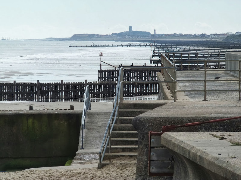
An easy 8 mile Norfolk coastal walk along beach and clifftops between Sheringham and Cromer
The Norfolk Coast Path was rerouted in 2014 as part of its inclusion to the England Coast Path. It now navigate alogn the cliff tops for most of the distance along what used to be permissive paths that have now become public. This walk uses both coast path and beach to create a delightful walk along this awe-inspiring section of the North Norfolk coast. Do check tide times and make sure the beach walk is undertaken 2 hours either side of low tide.
|
Thursday 19 December 2019
|
2 comments |
![]()
A 6 mile walk along the original route of the Norfolk Coast Path between Cromer and Sheringham
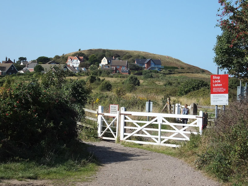
Up until December 2014 the official route of the Norfolk Coast Path from its start at Cromer Pier through to Sheringham navigated inland along the hills of the Cromer Ridge, the highest ground in Norfolk. This original route can still be walked and contrasts with the cliff-top route of the realigned path which is now part of the England Coast Path. With shady lanes and tracks through the woodland, spectacular views from the summit of Beacon Hill and the challenging ascent to the iconic Beeston Bump, this walk is a worthwhile excursion from the coastal route.
|
Wednesday 18 December 2019
|
No comments |
![]()
A 7 mile walk along Norfolk's Paston Way from Cromer to Gunton.
The Paston Way has a few alternative paths that stray from its main route between North Walsham and Cromer, and this walk takes the optional route out to Gunton from where a train can be taken back to Cromer. There are some worthy country pubs along this simple walk so a good old English pub crawl can also be had along with taking in the sights of the impressive churches at Northrepps and Southrepps plus local tales of wartime German conspiracies!
|
|
2 comments |
![]()
The future of the 2.5 mile walk along the sea defences between Blakeney and Cley
The December 2013 Storm Surge caused major damage to the sea defences along the Norfolk Coast Path that encompasses the Blakeney Freshes. Work is currently being carried out to repair the breaches, however the long term future of both the Freshes and the coast path at this point is uncertain.
|
|
No comments |
![]()
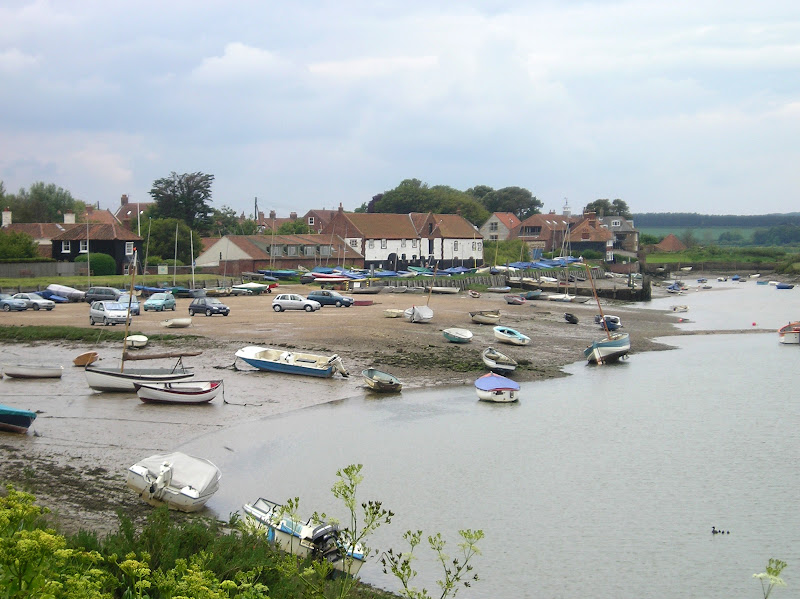
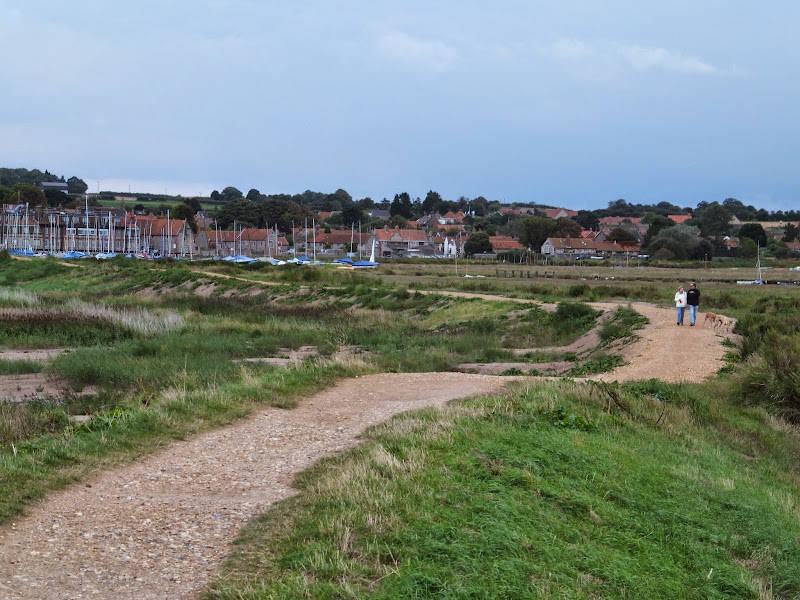
A 6 mile walk following the North Norfolk Coast Path between Burnham Overy Staithe to Brancaster
Wide open areas of marshland provide an enticing setting for this easy walk. Sailing boats, marsh, a tidal pool and the site of a Roman fort provide plenty of interest, together with three pubs, what more could one ask for of an afternoons stroll.
|
Tuesday 17 December 2019
|
No comments |
![]()
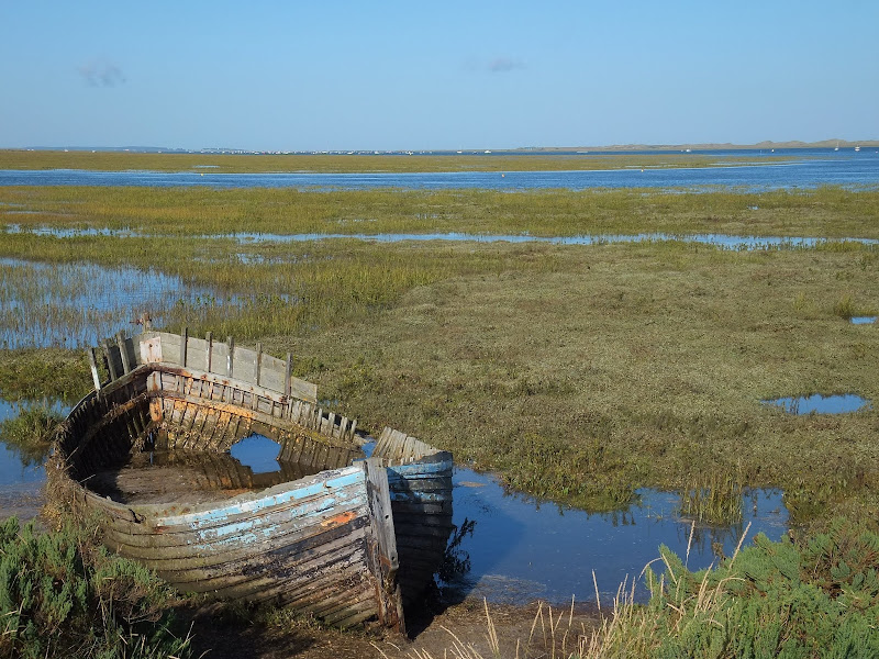
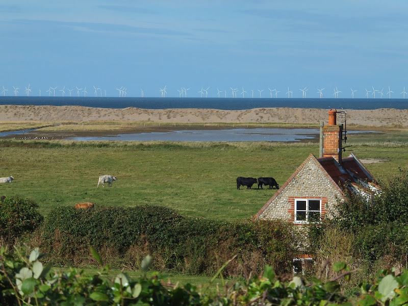
A 3 mile walk out to Brancaster Beach returning across the marsh to Titchwell
Although not included in the official Norfolk Coast Path route, this simple walk is a well worth excursion to witness the expanse of sand and dune as well as a petrified forest and an old wreck. Always be mindful of tide conditions and particularly do not attempt to get across to the wreck which lies across the Harbour channel.
|
Saturday 26 January 2019
|
No comments |
![]()
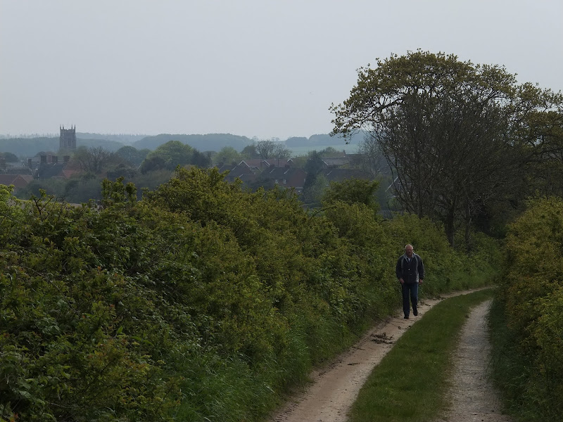
A 10 mile walk following the Norfolk Coast Path between Cley and Wells-next-the-Sea
An easy walk along the Norfolk Coast Path navigating out across the marshes to Blakeney then along the marsh perimeter to Wells. Blakeney is a worthy stopping point to explore Mariners Hill and the Guildhall and take in the legends of the Blakeney tunnels and the tragic story of the Blakeney Fiddler who is depicted on the village sign.
|
Friday 11 January 2019
|
No comments |
![]()

A 15 mile circular walk along the Norfolk Coast between Happisburgh and Horsey Gap to witness the Seals
This section of Norfolk's east coast is dependant upon time and tide so one needs to plan it well. At low tide there are vast sandy stretches all the way through to Horsey with such delights as witnessing seals sunning themselves on the beach, a sight one cannot fail to be impressed with. Whole colonies lay on the beach and each and every one of them appears to have a photogenic aptitude. With the advent of the England Coast Path, there is a route all the way back through the dunes or on the landward side of them.
|
|
2 comments |
![]()
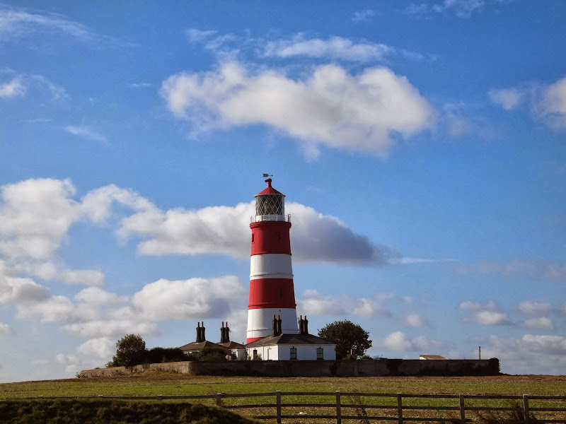
A simple 3 mile circular walk along the Norfolk Coast between Happisburgh and Eccles
Happisburgh is curious - it is slowly being taken by the sea, its houses slowly falling victim to the tides. The pub gardens boast a signal box to a railway line that never got built. A lighthouse stands guard to the south and its lifeboat is located at the next village of Eccles. In recent times the tide has uncovered prehistoric human footprints. And there is local folklore of ghostly smugglers and misdeeds. Very curious indeed.
|
Thursday 10 January 2019
|
No comments |
![]()
An 11 mile beach walk between along the Norfolk coast from Happisburgh to Winterton
Providing the tide is right, this is a fantastic beach walk with miles of golden sand and, if you are lucky, the sight of seals basking in the sunshine. Probably one of the best beach walks on this coastline.
|
|
No comments |
![]()

A 9 mile circular walk along the North Norfolk Coast between Holkham and Wells-next-the-sea
An alternative to the North Norfolk Coast Path, which follows the landward side of the large belt of pine trees known as Holkham Pines, is to walk along the glorious sandy Holkham beach. This was such a well worth experience with acres upon acres of sandy beach and dunes. With clear blue skies and a little sunshine this makes for a superb walk at any time of the year. The Albatros, a sailing ship that is permanently moored at Wells Quay provides some fine and simple lunches including fresh mussels which provide a fitting half way point to this walk. The return uses the tracks around the Holkham estate taking in views of the hall, the lake and obelisk.
|
Tuesday 8 January 2019
|
No comments |
![]()
A 20 mile walk along the Kings Lynn to Hunstanton section of the Iceni Way
There is no official footpath or right of way to walk the complete distance along the coast between Kings Lynn and Hunstanton. It can be done by navigating the defence banks and farm tracks and ignoring the odd 'No Access' sign. However, an alternative walk to link these two towns is to use the Iceni Way. This is a walk designated by the Ramblers using existing tracks and footpaths linking the interesting and scenic villages of Castle Rising, Sandringham and Dersingham before it navigates back to the shores of the Wash at Snettisham. With vast expanses of sand when the tide is out, this part of the coast is truly an awe-inspiring sight looking across towards Boston and Skegness. You can walk out for miles before the sea is reached.
|
Saturday 29 December 2018
|
No comments |
![]()
A 13 mile walk between the Norfolk coastal villages of Mundesley and Happisburgh
This walk comprises of a circular route taking in both the beach and the cliff-top paths between the two Norfolk coastal villages of Mundesley and Happisburgh. The centre of this walk is at Walcott where the cliffs recede and access to the beach is obtainable. This enables the walker to customise this route according to tidal conditions as both Happisburgh and Bacton beaches can be cut off by high tides.
|
Sunday 16 December 2018
|
1 comment |
![]()
A 10 mile alternative route for the North Norfolk Coast Path between Sheringham and Cley
This walk takes diversions from the official route of the North Norfolk Coast Path via the North Norfolk Railway and the Weybourne Priory Ruins. A further alternative is then used to navigate away from the strenuous shingle walk along the coast to a more gentle amble up to the village of Salthouse and across the hills to Cley. This provides a scenic and interesting alternative to the official route of the North Norfolk Coast Path and gives some spectacular views across the marshes from the hillside between Salthouse and Cley.
|
Thursday 6 December 2018
|
No comments |
![]()

The 14 miles Peter Scott Walk from Sutton Bridge to West Lynn, crossing the border from Lincolnshire to Norfolk
Leaving Sutton Bridge, this renowned walk heads down to the lighthouse made famous by the wildfowler turned conservationist Peter Scott. Few folk venture beyond this but those that do the full walk will be treated to the wide open views with the North Norfolk coast sitting on the horizon and the Wash Islands, a failed venture to create fresh water havens in this land of marsh and mud flats.
|
Tuesday 27 November 2018
|
No comments |
![]()
An 8.5 mile walk along a section of the Norfolk Coast Path between Wells-next-the-Sea and Morston, with a diversion through the village of Stiffkey.
Stiffkey (locally pronounced Stewkey) is referred to as Stivecai in the Domesday Book, which means "island of tree stumps". This is thought to relate to the remains of an ancient wooden structure dating back 8,000 years, that was found on the marsh. Today it is a sleepy little village on the North Norfolk Coast Road renowned for its topiary including a line of elephants all trunk to tail at Nellie's Cottage, a guitar sitting proudly atop a hedge at the home of a guitar teacher and a fox by the gate post of the Fox family's house. It does, nevertheless, have an intriguing recent history with stories of Black Shuck, the ghostly devil dog, and the tale of the infamous Reverend Harold Davidson, Rector of Stiffkey who was defrocked in a national scandal involving ladies of the night and ended up being mauled by a lion.
|
Thursday 22 November 2018
|
No comments |
![]()

A short walk from West Lynn to Kings Lynn including the Lynn Town Trail
A short walk that includes a town trail to view the historic centre of Kings Lynn. There is plenty of history here and the descriptions in this account scratch the surface of what has occurred through the ages. The feature that we concentrate upon in this instance is the legend that surrounds the burning of the witch Margaret Reed in the 16th century.
|
Wednesday 21 November 2018
|
No comments |
![]()
A 9 mile beach walk between along the Norfolk coast from Winterton to Great Yarmouth
This walk is probably better known as Robinson Crusoe's walk since this is where Daniel Defoe places his character, in the novel of the same name, after being shipwrecked with a resulting walk to Great Yarmouth. Although such a stormy day would not make the best of walks, when the sun shines and the tide is out this really is a great walk.
A 10 mile walk following the southern side of the parish boundary of Leiston in Suffolk This walk follows the route of a 17th century peramb...


