Route details, maps, pubs, features, local history and folklore for a wide variety of walks focusing primarily on Norfolk and Suffolk

East Suffolk Line Path Walks
Showing posts with label East Suffolk Line Path. Show all posts

Thursday 28 November 2019

A Walk to Suffolks Mystery Brampton Standing Stone

A 14 mile walk between Halesworth and Beccles along the East Suffolk Line Path

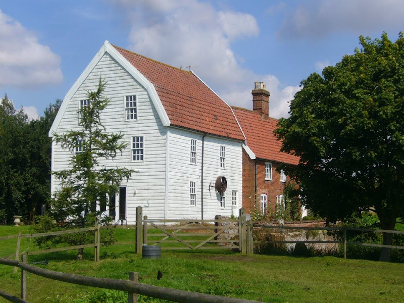
This waymarked route links the railway stations at Halesworth, Brampton and Beccles. Taking the train between these towns will provide an interesting glimpse of what is in store along the walk, including the rather curious Belle Grove Farm looking as if it is out of some fantasy movie and the mysterious Brampton Standing Stone just south of Brampton Station.
Friday 5 April 2019

The Alde Valley Walk - Leiston to Wickham Market

Beversham Mill

A 16 mile walk along the East Suffolk Line Path between Leiston and Wickham Market

Although the official route for the East Suffolk Line Path links the stations at Saxmundham and Campsea Ashe, this provides an alternative route using the local bus service to link the two ends. Highlights along the route include the picturesque Beversham Mill and the legendary Blaxhall Stone which is said to progressively grow in size.

Friday 18 January 2019

A Walk through the Garden of Suffolk

A 14 mile walk between Saxmundham and Darsham along the East Suffolk Line Walk.

It is Yoxford that gives us the name of this walk which is part of the East Suffolk Line Walks and this specific ramble extends the line walk to return to Leiston where a regular bus service connects the two ends. Yoxford sits on the banks of the River Yox surrounded by three country house parks; Sibton Park that contains large well stocked fishing lake; Grove Park situated in the village; and Rookery Park on the Leiston road. This has earned Yoxford the name of the 'Garden of Suffolk'. The whole route of this walk is a pleasant amble through the rural fields of Suffolk with a return journey through the pretty country lanes following the Minsmere river through to Middleton, Theberton and finally Leiston.

Sunday 13 January 2019

East Suffolk Line Walk - The Yox Blyth Walk

Mells village

A 10 mile walk along the East Suffolk Line Trail between Halesworth and Darsham

Great views are to be had along the Blyth valley before footpaths head over to the Yox valley. The village of Bramfield is at the half way point where is an old pub for refreshments as well as a distinctive church with a detached tower and a fine example of a Crinkle Crankle Wall, not to mention the legendary Bramfield Oak.

Friday 28 December 2018

Angles Way - Oulton Broad to Beccles

Beccles

A 9 mile walk along the Angles Way between Oulton Broad and Beccles in Suffolk

The path between Oulton Broad and Beccles doubles up as both The Angles Way and the East Suffolk Coast Line walk. There is not much to this walk other than following the winding path alongside the River Waveney. It is a pleasant enough stroll but without much activity on the river it can become a little monotonous until Beccles approaches. Nonetheless, what a better way than to spend a sunny afternoon other than ambling alongside the river.

Monday 17 December 2018

Saxmundham, Kelsale and Carlton Circular Walk

Kelsale church from the other side of the railway

A 4 mile walk around Saxmundham, Kelsale and Carlton

Using footpaths an country lanes, this short walk provides some fine views, historic churches and even a ghostly tale of an apparition of phantom dancers. A worthy candidate for an afternoons exploration of this hidden corner of East Suffolk.

Tales of Sundials, Witchcraft and Ghostly happenings in Saxmundham

A 2 mile circular walk around the Suffolk town of Saxmundham using the Town Trail

A simple tour of Saxmundham that can be added onto the East Suffolk Line Walks or to while away a couple of hours on a lazy afternoon, including searching out the unique tombstone sundial in St Johns churchyard, and finding the haunted Monks Cottages.

Tuesday 27 November 2018

Ufford Heritage Trail

Smock Meadow floods

A 3 mile walk around the village of Ufford

Ufford is rich in heritage and well worth exploring. The Heritage Trail was created in 2006 and leads the walker around the historic features of the village including the village stocks, water meadows and the many listed buildings. The Highlight of the trail has to be the church which has the unusual dedication to St Mary of the Assumption and contains the second largest font cover in England which is a sight to behold.

Wednesday 21 November 2018

The Fonnereau Way to Ipswich

Christchurch Park

A 12 mile walk between Woodbridge and Ipswich incorporating sections from the Fonnereau Way, the Sandlings and the Fynn Valley Way

This walk links the railway stations of Woodbridge, Westerfield and Ipswich with scenic views along the estuary at Woodbridge and the Fynn Valley before entering Ipswich from the west through the historic parkland known as Christchurch park which dates from the 12th century which includes many historic features and a mansion that is open to the public.

Deben Valley Walk from Wickham Market to Woodbridge

An 8 mile walk along the Deben Valley in Suffolk from Wickham Market to Woodbridge

This walk follows the route of the East Suffolk Line Walks along the Deben Valley. An easy and simple walk with the highlight of the village of Ufford which boasts its very own microbrewery and ancient church. The walk ends with an amble along the popular riverside path between Melton and Woodbridge.

Walk Summaries

Latest walk summaries are basic information sheets for walks that have yet to be fully documented. These provide links to maps, public transport and walks stats, although detailed notes and features are not included.

Latest Walk Summaries

Featured Walk

In Search of Sizewell Chapel

A 10 mile walk following the southern side of the parish boundary of Leiston in Suffolk This walk follows the route of a 17th century peramb...

What is GPX

All you need to know about GPX, electronic mapping and how to use modern apps and mobile devices as navigation devices

Popular Walks

Maps