Route details, maps, pubs, features, local history and folklore for a wide variety of walks focusing primarily on Norfolk and Suffolk

Walks
Showing posts sorted by relevance for query Yealmpton. Sort by date Show all posts

Tuesday 20 November 2018

South West Coast Path - Yealm Estuary to Avon Estuary

Erme Estuary

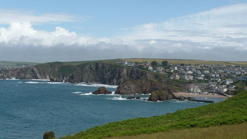
A 19.5 mile walk along the South West Coast Path between the Yealm and Estuaries, using additional footpaths to access transport to link each end of the walk.

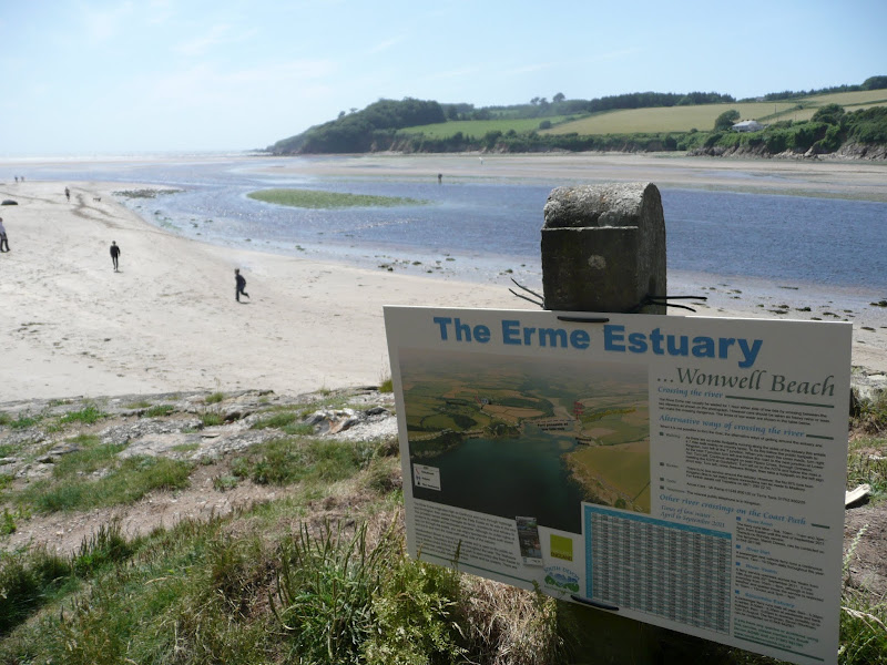
There are ferries across both the Avon and the Yealm estuaries but this route takes a trail that enables navigation around them using footpaths and lanes. Even so, there is still the Erme estuary to negotiate midway along the coast. There is no ferry here but it can be waded across one hour either side of low tide. This is quite an experience but requires planning with reference to the tide times published for Devonport. There are few other features apart from the stunning scenery along this section of the coast walk until it gets to Bigbury on Sea where Burgh Island sits just off the coast and hosts the renowned Pilchard Inn. The island can be reached on foot at low tide and at other times the inn makes use of a sea tractor to drive visitors across.

Thursday 27 December 2018

South West Coast Path - Plymouth to Yealm Estuary

Wembury

A walk along the South West Coast Path between Plymouth and the Yealm estuary with an extension along the Erme Plym Trail to get around the River Yealm estuary

Plymouth is not a place to find a country walk, in fact the South West coast Path leads you around some of the more industrial areas of the docks and along the busy road across Laira Bridge. From this point there is a more pleasant alternative route using the West Devon Path which traces the trackbed of a former railway to Hooe Lake. An easy walk around Clovelly Bay and Mount Batten Point finally brings the path onto the cliffs along the coast. The going through to Wembury is not too strenuous and it is worth taking time out at Heybrooke Bay to search out the Eddystone Inn from where you can see the lighthouse of the same name on the horizon. From Wembury the Erme Plym Trail leads back to the main road in order to get around the Avon Estuary.

Wednesday 18 December 2019

South West Coast Path - Avon Estuary to Salcombe

Hope Coast

A 17 mile walk along the South West Coast Path between Churchstow and Salcombe.

This walk heads out from Churchstow through country lanes down to the South West Coast Path at Bantham on the Avon estuary. The Coast Path starts with easy walking along the low cliffs past Thurlestone and includes an 80 yard footbridge across South Milton Ley before it arrives at Hope Cove, a picturesque little fishing village. The section from Bolt Tail to Bolt Head is a little more strenuous with the path tracking up and down the cliffs and around a few craggy sections with steps built out of the stone. At Bolt Head the coast bears round to the north passing Sharp Tor which is cut out of the cliff-face, before it heads down into the pretty village of Salcombe.

Walk Summaries

Latest walk summaries are basic information sheets for walks that have yet to be fully documented. These provide links to maps, public transport and walks stats, although detailed notes and features are not included.

Latest Walk Summaries

Featured Walk

In Search of Sizewell Chapel

A 10 mile walk following the southern side of the parish boundary of Leiston in Suffolk This walk follows the route of a 17th century peramb...

What is GPX

All you need to know about GPX, electronic mapping and how to use modern apps and mobile devices as navigation devices

Popular Walks

Maps