Route details, maps, pubs, features, local history and folklore for a wide variety of walks focusing primarily on Norfolk and Suffolk

Walks
Showing posts sorted by relevance for query Runton. Sort by date Show all posts

Thursday 24 January 2019

Folklore Trail around East Runton

Railway bridge at the end of Thains Lane with Inclborough Hill in the background

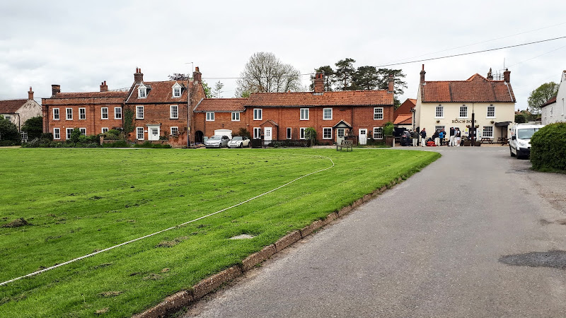
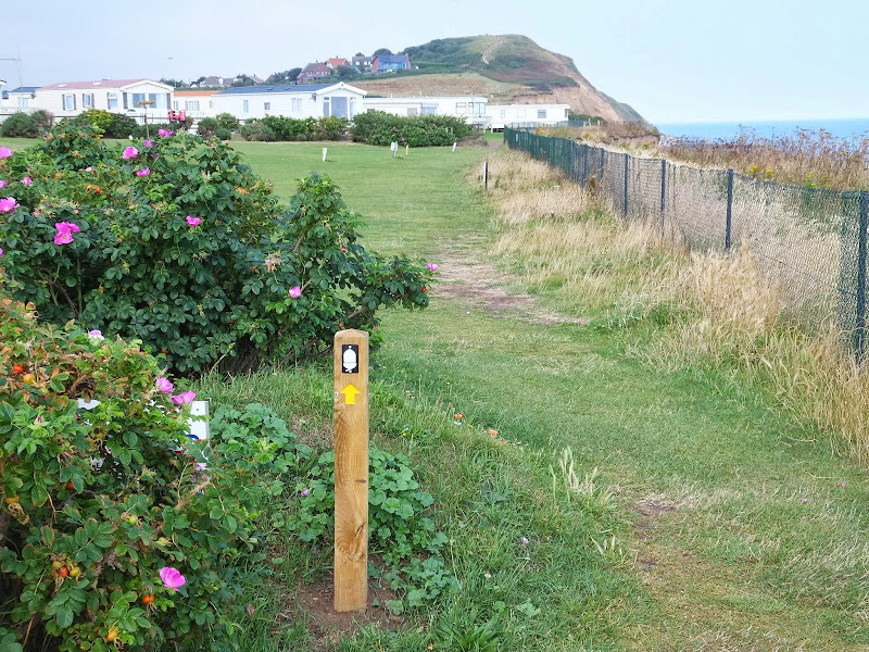
A 4 mile walk between East Runton and Cromer searching out old folklore

Using country lanes and tracks, this circular trail navigates around a East Runton to visit the various locations in Runtons history and folklore. Woodhill House is the location of an unidentified skeleton found during road widening. Thains Lane has the village's old smithy. The old Windmill sets the scene for the emanation of ghostly lights that crossed over to a copse. With a pub stop at Cromer and return via the redefined course of the Norfolk Coast Path, this makes for an excellent short walk on a spooky Autumn evening.

Thursday 19 December 2019

In search of the Becks and Ponds of Beeston Regis

View from foot of Incleborough Hill

A 7 mile walk between East Runton and Sheringham in Norfolk, searching out a couple of good pubs and following Beeston Beck across Beeston Common.

This picturesque trail follows the foot of Inkleborough Hill to West Runton then navigates down to the northern end of Beeston Back Common where it follows the stream known as Beeston Beck down into Sheringham, past the site of an old watermill, now replaced by terraces of housing. Return is via West Runton with a stop at the Village Inn. At only 7 miles, this is a simple and easy afternoons stroll.

The Aftermath of the 2013 Storm Surge - Cromer and Sheringham

Damaged Beach huts

A 6 mile beach walk to witness the damage caused by the 2013 Storm Surge at Cromer and Sheringham

Both Cromer and Sheringham bore the brunt of the storm surge on the night of December 5th 2013. Although repair work is well under way there are still the signs of what damage the sea can cause. There have also been many cliff falls along this length of coastline with the cliff faces providing a fascinating view sculptured by the weather and tides and offering multi coloured strata.

Thursday 30 August 2018

Runton and Incleborough Hill Walk Sumary

Salt marsh

Short circular walk over Incleborough Hill in North Norfolk

Incleborough Hill stands above the villages of East and West Runton on the North Norfolk Coast. At 260 feet in height and covered with low level gorse bushes it provides magnificent unobstructed views across the coast from Cromer to Sheringhamm and beyond. One cannot help but be impressed and in awe at the sight.

The walk is not arduous and apart from a short climb up steps it is achievable by most able bodied folk. The return is down a much gentler slope to West Runton and to the coast to follow the Norfolk Coast path back to East Runton.

Wednesday 16 March 2022

Sunday 12 December 2021

East Runton to Aldborough Circular Walk

Aldborough

A 17 mile circular walk through the countryside of North Norfolk linking East Runton and Aldborough

Aldborough is the quintessential English village with a pub facing the large village green where the sound of willow on leather can be heard from the afternoon games of cricket that are frequently staged during lazy summer afternoons. You cannot get a more stereotypically English village than Aldborough.

Thursday 25 August 2011

North Norfolk Railway Beer Festival 2011

The 10th North Norfolk Railway beer festival

There was a selection of 120 ales from around the country plus a range of ciders and perrys all for the price of £2.80 a pint. Entertainment and food was available throughout the weekend together with both diesel and steam train workings to make a truly unique event. Even the rain throughout the weekend could not dampen the enthusiasm of those attending, with plenty of shelter available in the carriages alongside Platform 2 where the beer tent was situated. This was an excellent weekend with ample opportunity for some walking along the picturesque coast to Cromer. There was also a late bus between Sheringham and Cromer calling at Woodhill saving us the walk across Beeston Bump in the dark back to the campstie at East Runton. When it comes to beer festivals you cannot beat this one.

Friday 20 July 2012

North Norfolk Railway Beer Festival 2012

Beer Festival

The 11th North Norfolk Railway beer festival

Once again the North Norfolk Railway came up with another outstanding beer festival. Over 100 ales plus ciders were on offer in the perfect surroundings of a working steam railway together with live music. Carriages on platform 2 gave ample seating and cover for the few times when rain began to fall and a bbq in a wagon offered hotdogs and burgers. In my opinion the best beer festival around!

Thursday 19 December 2019

Cromer to Mundesley Beach Walk

Cromer

A beach walk along the Norfolk Coast between Mundesley and Cromer including a clifftop stroll from Cromer to Overstrand.

This section of the Norfolk Coast can only be walked when the tide allows as high tide reaches the foot of the cliffs and is impassable at Overstrand. There is frequent erosion all along the route so the scenery changes from year to year. The beach is predominantly sand with numerous groynes that present frequent obstacles to get past - sometimes decaying steps assist getting over the groynes and sometimes, at low tide or with boots and socks off, it is possible to get around the end of some of the groynes. Mostly, it involves clambering as best as you can over these eroded, seaweed covered, mussel encrusted defences but that is half the fun of it! Although there is a cliff top path from Cromer to Overstrand, which has some outstanding views, beyond this there is no official right of way and a full circular walk would involve heading inland, using the Paston Way. However, a frequent bus service links Overstrand and Mundesley to make a good and easy days coast walking.

Wednesday 7 September 2011

Ale Trail - Mundesley to Cromer

Cromer

A beach walk along the Norfolk Coast between Mundesley and Cromer including a clifftop stroll from Cromer to Overstrand.

This section of the Norfolk Coast can only be walked when the tide allows as high tide reaches the foot of the cliffs and is impassable at Overstrand. There is frequent erosion all along the route so the scenery changes from year to year. The beach is predominantly sand with numerous groynes that present frequent obstacles to get past - sometimes decaying steps assist getting over the groynes and sometimes, at low tide or with boots and socks off, it is possible to get around the end of some of the groynes. Mostly, it involves clambering as best as you can over these eroded, seaweed covered, mussel encrusted defences but that is half the fun of it! Although there is a cliff top path from Cromer to Overstrand, which has some outstanding views, beyond this there is no official right of way and a full circular walk would involve heading inland, using the Paston Way. However, a frequent bus service links Overstrand and Mundesley to make a good and easy days coast walking.

Thursday 19 December 2019

Old Coast Path Route - Cromer to Sheringham

Beeston Bump

A 6 mile walk along the original route of the Norfolk Coast Path between Cromer and Sheringham

Up until December 2014 the official route of the Norfolk Coast Path from its start at Cromer Pier through to Sheringham navigated inland along the hills of the Cromer Ridge, the highest ground in Norfolk. This original route can still be walked and contrasts with the cliff-top route of the realigned path which is now part of the England Coast Path. With shady lanes and tracks through the woodland, spectacular views from the summit of Beacon Hill and the challenging ascent to the iconic Beeston Bump, this walk is a worthwhile excursion from the coastal route.

Wednesday 9 January 2019

Salthouse Sculpture Trail

Pond at Kelling Heath

A 14 mile walk around the Salthouse Sculpture Trail

Inaugurated in 2008 by The North Norfolk Exhibition Projects, this trail across Kelling and Salthouse heaths was set out to exhibit both the natural beauty of North Norfolk alongside examples of contemporary Norfolk art. Although most of the sculptures have now gone, the walk nonetheless provides a peaceful route around this part of the county.

Tuesday 24 December 2019

Sheringham to Cromer Circular Walk

An easy 8 mile Norfolk coastal walk along beach and clifftops between Sheringham and Cromer

The Norfolk Coast Path was rerouted in 2014 as part of its inclusion to the England Coast Path. It now navigate alogn the cliff tops for most of the distance along what used to be permissive paths that have now become public. This walk uses both coast path and beach to create a delightful walk along this awe-inspiring section of the North Norfolk coast. Do check tide times and make sure the beach walk is undertaken 2 hours either side of low tide.

Tuesday 29 July 2014

Norfolk Coast Path Extension

Coastline from Mundesley to Happisburgh

A 21 mile extension has recently been completed to the Norfolk Coast Path taking it through to Sea Palling

As part of the English Coast Path project, the Norfolk Coast path has now been extended to Sea Palling with waymarkers and direction signs being added during the first half of July. This includes a redirected section between Beeston and Cromer that now follows the coast rather than its original route which headed inland through the hills above Cromer.

Wednesday 18 December 2019

Paston Way to Gunton - Pubs, Churches and Wartime Conspiracies

Northrepps from the lane to Overstrand

A 7 mile walk along Norfolk's Paston Way from Cromer to Gunton.

The Paston Way has a few alternative paths that stray from its main route between North Walsham and Cromer, and this walk takes the optional route out to Gunton from where a train can be taken back to Cromer. There are some worthy country pubs along this simple walk so a good old English pub crawl can also be had along with taking in the sights of the impressive churches at Northrepps and Southrepps plus local tales of wartime German conspiracies!

Saturday 29 December 2018

A Norfolk Broads Walk from Neatishead to Horning

Cormorants on Barton Broad

An easy 6 mile walk following the River Ant down to the Bure at Horning.

The Norfolk Broads are full of ghostly stories and this walk brings a few to life. From the spooky lights of Hoards Hole, encounters with Black Shuck and the curious transformation of Horning's riverside houses to Saxon days when it was just a grassy bank, there is plenty to reflect upon as one wanders the footpaths and quiet country lanes that make up this route. And maybe, who may tell, given the right conditions, you may even glimpse a spectral view from another dimension.

Tuesday 17 December 2019

A Walk along the Bure Valley Path

A 9 mile walk along Norfolk's Bure Valley Path between Aylsham and Wroxham

The Bure Valley Path follows the former Great Eastern Railway trackbed alongside the Bure Valley Narrow Gauge Railway. There are outstanding views of the river Bure and stops on route at Brampton, Buxton and Coltishall. Being a former trackbed gives a well drained path so the route is suitable for all weathers.

Thursday 17 March 2022

Leiston to Middleton Mill Circular Walk

Leiston to Middleton Mill Circular Walk

A walk across the coastal Suffolk countryside to the village of Middleton

A splendid way to spend a days walking, cross fields and countryside and heading to the location of the Middleton Watermill. There are churches to stop and investigate on the way.

Sunday 23 October 2011

Completion of The Woodfordes Ale Trail 2011

The Woodfordes Ale Trail ended on 30th September and it was time to total up our stamps and collect our prizes. To recollect the rules, one has to visit Woodfordes outlets that are contained in their 2011 guide and on purchasing a pint of Woodfordes ale the publican will add an entry to the Trail Card with a unique stamp. There is only one stamp allowed for each venue and the trail only runs from June to the end of September. There is a different prize for collecting multiples of 10 stamps with the top prize being a polypin of ale for 60 stamps. In 2009 we managed to fill 2 Trail Cards and had started a third giving us a bounty of 2 polypins and a Nelsons Revenge t-shirt. This year we were not as successful due to being away from the area for a few weeks over the summer months. The end result was that we only completed half of the card. Nonetheless, this was thirty stamps collected which was rewarded with a mighty fine Woodfordes Hoody worth £25 as modelled by Kat in the photo above, an item that will most certainly keep us warm on our camping and walking expeditions

Sunday 31 May 2015

Dads Army Weekend 2015

Dont panic Mr Mainwaring

An easy 9 mile Norfolk coastal walk to visit the Dads Army weekend hosted on the North Norfolk Railway

The third episode of the sixth series of the popular British comedy series Dad's Army was titled 'The Royal Train' in which King George VI was due to pass through Walmington-on-Sea and the platoon were to form a guard of honour. The location chosen to film this episode was Weybourne station on the North Norfolk Railway and each year this is celebrated with a Dad's Army weekend where a group of enthusiasts from the Dads Army Museum in Thetford re-enact this memorable episode.

Walk Summaries

Latest walk summaries are basic information sheets for walks that have yet to be fully documented. These provide links to maps, public transport and walks stats, although detailed notes and features are not included.

Latest Walk Summaries

Featured Walk

In Search of Sizewell Chapel

A 10 mile walk following the southern side of the parish boundary of Leiston in Suffolk This walk follows the route of a 17th century peramb...

What is GPX

All you need to know about GPX, electronic mapping and how to use modern apps and mobile devices as navigation devices

Popular Walks

Maps