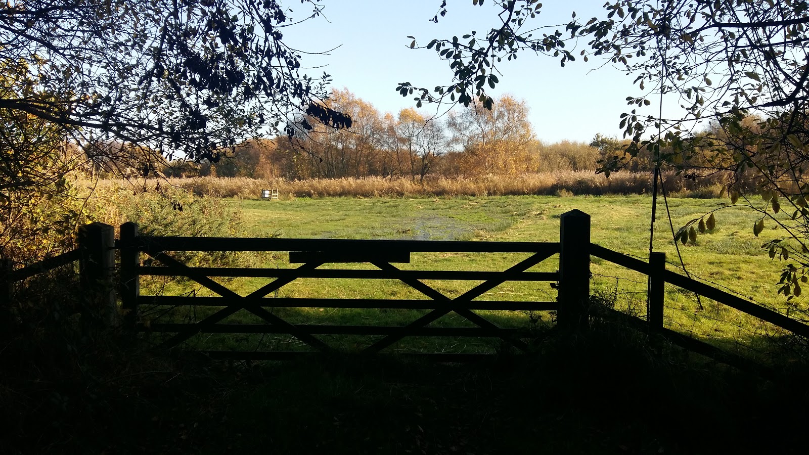
A 7 mile walk following the western parish boundary of Leiston in Suffolk, as described in a document from the middle-ages
This walk attempts to follow the instructions of a perambulation around the western side of the Leiston Parish boundary that was undertaken in the year AD1620. Leiston's history is renowned for its Abbey and the Garret's works, but this walk also discovers the site of a possible ancient pre-Christian shrine or temple, the location of the Leiston gallows and the procession route taken by those attending this gruesome public spectacle.
A 10 mile circular walk around Leiston and Eastbridge in Suffolk
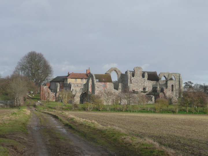
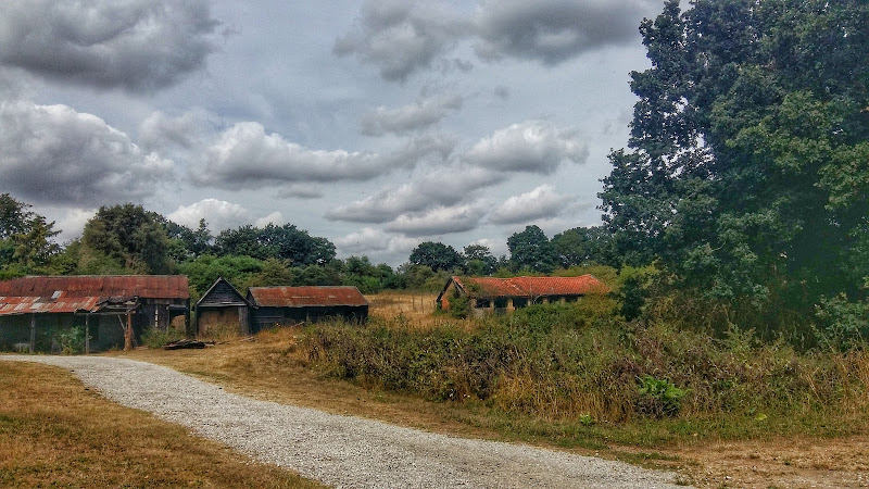
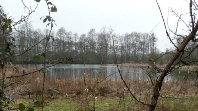
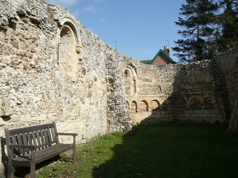
Leiston Abbey was originally founded in the late 12th century by Ranulf de Glanville. The original building was constructed on an island in the Minsmere marshes. Two centuries later, due to the inhospitable conditions on the marsh and constant flooding the Abbey was moved inland, lock stock and stone to a site close to Leiston. Despite a great fire in 1367 and much demolition following the dissolution of the monasteries there still remains some impressive ruins. There is still a remnant of the old Abbey, with the former chapel building sitting in its island position above the marsh, decaying into the landscape and containing a WWII pill box. This walk visits both sites making a well worthwhile walk.
A 6 mile walk around the heaths and commons of Coldfair Green
This walk follows an investigation to seek out the location of the Leiston Gibbet and an area of heathland that was known in the 1600's as Friday Market Heath. The only reference to these places comes from an old book from 1910 entitled 'The Chronicles of Theberton' which details the route past the gibbet. This walk attempts to retrace this route by navigating along the heathland and footpaths around the River Hundred which marks the boundary between the hundreds of Blything and Plomestead. Extensive research which has been undertaken and documented in the feature of this walk with some revealing insights to long forgotten places.
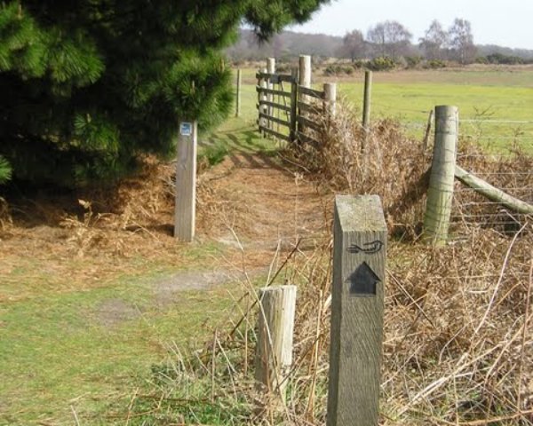
A 10 mile walk following the southern side of the parish boundary of Leiston in Suffolk
This walk follows the route of a 17th century perambulation around the southern side of the Leiston Parish boundary. The walk uses the ancient track down to Sizewell and continues down to Thorpe before turning inland to follow the River Hundred through to Cold Fair Green. The details are contained in two articles, this being the first, focusing on the medieval history of Sizewell.
A 5 mile walk across the Coastal Suffolk landscape between Leiston and Saxmundham
This walk searches out footpaths to connect the neighbouring towns of Leiston and Suffolk. Although there is no direct route, the paths chosen are certainly more conducive to the walker than the busy road route. With the churches of Leiston and Knodishall on the route, plus the mysterious Harris's Pit in the parish of Sternfield there is enough to interest the avid rambler. Sternfield also has the notoriety of being the village from which the last woman to be burnt at the stake in England came.
A 10 mile circular walk through the Suffolk Coastal Area of Outstanding Natural Beauty taking in Sizewell and the Minsmere Bird Reserve
One does not have to have an enthusiasm for ornithology to enjoy this walk. The natural surroundings of marshland and heathland are enough to inspire everyone and there is a lot of associated history along this route which dates back to the 12th century when Leiston Abbey once occupied an island in the marshes. Note that charges apply to the Minsmere section.
A circular walk encapsulating Leiston Airfield, Theberton woods and the Minsmere River
Few may have heard of Reckford and indeed as a location it is pretty much lost in the landscape. There is a Reckford Road in the neighbouring village and there is a 16th century Reckford Farmhouse and there is the Reckford Bridge but to all intents and purposes the community of Reckford is not recognised, just a small area of the village of Middleton. Whether the area was ever judged to be a village is unknown. Nonetheless we will make it the destination of this circular walk.
The walk has much to feast ones eyes upon. The former WWII Leiston airbase commonly known as RAF Leiston hosted the USAF 357th Fighter Group who were locally known as the Yoxford Boys. Little is left although there is a memorial that pays homage to the US crews that flew out of this airfield and never returned. There are some hidden remnants in the landscape, a broken up runway that crosses the farmland, old buildings that have camoflaged themselves in the undergrowth and now either lie redundant of have been put to use as farm buildings.
The walk continues onto the broadleaved woodland known as Theberton Woods before navigating down the quiet country lanes and tracks to Reckford.
Return is along the banks of the Minsmere river to Eastbridge then back to Leiston via the Abbey ruins.
A 9 mile circular walk that links Knodishall and Sizewell Belts along Suffolk's Sandlings Trail
An easy walk across the typical heaths and commons of Coastal East Suffolk that make up the Sandlings. There is woodland, marsh, and rambling sandy heath full of flora fauna and wildlife.
NOTE: The section from Sizewell through to Leiston Common, Sizewell Belts is no longer part of the official Sandlings path. It has been rerouted along the beach in front of the power station and then through Kenton Hill woods. This Sizewell Belts walk as described here is still accessible using permissive paths.
An Amazing Adventure to Westleton Barrel Fair 2010
A 9 mile return Suffolk walk from Leiston to Westleton to attend the annual Westleton Barrel Fair
This isnt a walk that I would normally include as it is not really a true circular walk, but Westleton Barrel Fayre is worth the mention in itself! Each year Westleton Village organises the mid-August fayre and rather than driving to the event it is just as easy to walk the 4.5 miles. You can walk down the lanes from Leiston to Eastbridge, but as there had been so much rain in recent days, we decided to keep to the road. There is a pavement out of Leiston, then the road to Eastbridge is a one lane track with little traffic. Then it is a pleasant walk through the woods. Westleton Barrel Fayre was a most excellent adventure
A walk encompassing the Westwood Marshes footpath into a circular route from Leiston
The Westwood Marshes footpath is little gem of a path that links the Newdelight Walks with the Suffolk Coast Path through the Westwood marshes. The route for this walk uses this path as the ultimate destination from Leiston but shorter alternatives to include this path are also detailed.
An easy 7 mile circular walk through the woodland around Sizewell on the Suffolk Coast
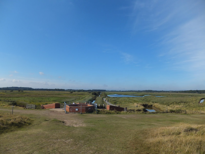
Suffolk is not best known for its hills and Kenton Hill and Goose Hill probably would not be regarded as hills but for their name. However this wooded area offers an ever changing scenery throughout the year with the mixture of conifer and broad leafed trees, flora and fauna and a variety of wildlife. There is also a viewing platform overlooking the Minsmere marshes
A 13 mile circular walk along the Sandlings Walk between Knodishall and Snape
With limited public transport this walk offers a circular route to incorporate the Sandlings path from Knodishall to Snape. Starting and ending at nearby Leiston it incorporates The Sailors Path and the Suffolk Coast Path to make a worthwhile day walk. The route passes Friston mill and Hall and the burial grounds where a Saxon burial ship was discovered. With pubs at Friston and Snape it provides for a great days ramble.
A circular walk around the Area of Outstanding Natural Beauty at Sizewell
This walk has a diverse landscape that has something for everyone. Woodland, coast and beach, freshwater marsh and Sandlings Heath which is a delight to any visitor and worthy of its status as an Area of Outstanding Natural Beauty. The walk heads out of Leiston alongside the man-made Aldhurst Farm nature reserve, an area of wetland, heath and grassland created in 2015 as a sweetener for the local folk should the proposed Sizewell C Power Station get approval. It isn't presently accessible to the public other than the established footpath that runs along the valley and a new path running adjacent to Valley Road. The north side of the reserve was once known as Winters Heath, common land that was enclosed in the early 19th century. Therefore this is not so much as giving something to the community as returning the access rights to the people that such common land once afforded.
Views across the marsh to minsmere, an area that will be covered with spoil heaps from the construction of Sizewell C
Moving on up to the top of the hill on Lovers Lane where we take the track off to the right as the road bends around to the left. An interesting feature on the OS maps at this location is an area marked as Fiscal Policy. This is thought to be a so called Trap Street, a fictitious location that is used as a copyright marker for the cartographers work. This specific fictitious location has been added to OS maps since the 1920s and has varied its exact location over the decades, although keeping within the general area of the western side of Kenton Hills. It is certainly not a location known to locals and appears on no other maps of the area other than the Ordnance Survey. It is notable that there are many references to the area of Fiscal Policy made in modern documentation written by both Suffolk Council and EDF, the Power Station operators. This goes to show the lack of local knowledge these bureaucrats and business managers have which may account for their scant respect for the surrounding landscape.
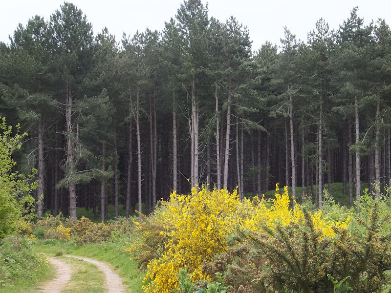
The route then heads through a car park and into the woodland through the areas known as Kenton (marked as Tenton on 19th century OS maps) and Goose Hills. The naming of the area as Hills is not self evident from the tree covered landscape. It has to be said that there is a triangulation station in the depths of Goose Hill but this is only at an altitude of 9m with the surrounding landscape no less than 5m. I guess a mere 4m high piece of land surrounded by marsh may look like a hill but it certainly is not self evident within the dense forest. The names of Kenton Hill and Goose Hill date back from long before the forest was planted, when the area was Sandlings heathland. It wasn't until the 1960s, with the coming of Sizewell Nuclear Power Station, that the heath was planted with a managed forest. Going back further in history the area is thought to have been parkland attached with the 14th century Leiston Abbey, some documents describing it as a deer park.
There are many tracks through the woods including a section of the The Sandlings long distance trail as well as specific colour coded way-marked trails. This particular route takes the unmarked perimeter paths out to the extremities of Goose Hill where there are views onto the marshes to the south of Minsmere and a purpose built hide for those who want to spend some time discovering the wildlife of the marsh. Whatever route one takes, navigating to the eastern edge one will find two footbridges which provide access across to the coastal section of this walk.
Goose Hill and Kenton Hill Woodland
Sizewell beach offers both coastal heath and a shingle beach to walk along. The northern section at the point where the path emerges from the woods, was once a 19th century rifle range which I believe was also used during WWI as target practice for the troops. The beach and heath paths pass in the front of the two power stations at Sizewell and is a very popular for both tourists and locals walking through to Minsmere Sluice and beyond. For those wanting refreshments there is the Vulcan Arms pub at Sizewell as well as the Sizewell T cafe although this is closed over the winter months.
Return uses the medieval track through to Broom Covert. This was the original route between Leiston and Sizewell before the modern road was introduced in the 19th century. Broom Covert is an area of ancient Sandlings heath that is a delight to walk through and is another highlight of this walk, its contoured grassland hinting at hidden earthworks that may lie beneath. It is thought that this area was extensively used for troop training during WWII and there may be hidden structures dating from this period lying beneath the surface.
A permissive path leads across the meadow at Round Covert to Reckham Pits Wood which was originally part of Leiston Common, the woodland growing up in the early 20th century after it had been used for aggregate excavation. The mixed woodland is a much wilder landscape than that of Kenton Hills, with a cacophony of trees, foliage and fauna all competing for space, a blaze of colour and light in all seasons. Above the woodland is what is left of Leiston Common, correctly known as Leiston Dry Common to distinguish it from Leiston Wet Common which once occupied part of the marshes. The Common features in many local tales and stories of 18th century smugglers who would stash their booty in holes dug into the sandy soils of the common. There is a permissive path on the north side of the common that leads down to the marsh known as Sizewell Belts and across to Kenton Hill woods. The public footpath leads out onto Lovers Lane with a new footpath adjacent to Valley Road to take the walker back into Leiston.
Broom Covert, natural Sandlings heathland
It has to be stated that much of the landscape this route passes through may disappear in the next decade due to industrial usage despite its status as an Area of Outstanding Natural Beauty. The proposed Sizewell C power station will claim some of the woodland, specifically much of Goose Hill which will be replaced by an access road to the construction site and a railhead. The route of the proposed railway will run adjacent to Kenton Hills and may well devastate the fictitious area known as Fiscal Policy!. No doubt Goose Hill will be flattened with the introduction of the road, its trig point no longer applicable with the tallest structures becoming the 20-30m high spoil heaps which will dominate the landscape from the present site of Sizewell B through to Minsmere sluice and across to Eastbridge.
Public access to the woodland may become limited with no access through to the beach. The coastal access will be restricted during the construction of a loading jetty and sea defences, and the coast path may be blocked up for the duration of the build depending upon the design of the pier head that is chosen. The long distance routes of the Coast Path and the Sandlings Path will get diverted along Lovers lane and then taking the roads through to Eastbridge, a lengthy diversion along asphalt which is not conducive to committed walkers and hikers. There will no doubt be contention between road users and pedestrians, such confrontations already occur when walking the local roads so this will only get worse with the increased traffic. This re-routing is a big concern as many walkers make use of the coastal section from Sizewell through to Minsmere which makes the local area an attraction for outside visitors who may well be put off by such unpleasant walking diversions.
On the southern side of the route, Broom Covert was set to be requisitioned for the construction of Proposed East Anglia One/Two Windfarm Substations which were set to dominate the area, its buildings being some 18m in height. There was much opposition to this, the land being a prime example of Sandlings Heath and deserving of its Area of Outstanding Natural Beauty status. Fortunately it seems this threat has abated in preference to a site at Friston which itself is gaining significant opposition. The coastal land between Thorpeness and Sizewell is still threatened to be torn up and footpaths blocked up. Considering that this area is popular with both locals and visitors alike, it demonstrates the lack of local knowledge these corporations have of the area and just how much it attracts visitors. When, at a recent exhibition of the proposed development, the question about the blocking up of footpaths was put to ScottishPower Renewables, the rep seemed honestly aghast that we had walked two miles to get to the exhibition in Thorpeness. This demonstrates their lack of knowledge of the area. We walk. Two miles is around the corner. We do not want to be forced into cars. These footpaths are our access along the coast.
There are already two windfarm substations constructed at Sizewell. The big issue with all of this is each Power company appears to want their own substations whereas a more holistic and integrated policy would cause less development, less disruption and benefit all. Probably the best idea would be to have an off-shore ring main to connect all of these power sources rather than bringing the lines to a separate substations for every single wind farm that is built. However the power companies do not appear to be interested in such solutions. Cooperation appears to be a dirty word to these monolithic corporations.
To cap it all, there is an idea being put about to market this section of natural heath, marsh and sandling coastline as The Energy Coast. This is a gimmick to put a cosy name to what will be no more than industrialisation of the Suffolk Coastline. There are a lot of people out there, both local and from further afield who would prefer this to stay as a natural coast, a coast that harbours wildlife, where one can seek solace and peace, where one can sit or stand and admire the landscape, not a huge construction site under the marketed guise of The Energy Coast.
Finally, jumping the gun with the assumption that the construction of Sizewell C is a foregone conclusion, EDF have been given the permission to extend Sizewell B, destroying the 100 year old Coronation Wood in the proceess in order to accommodate a car park. This is currently being opposed by a local groups who have succeeded in forcing a judicial review in the High Court to challenge the planning decision.
Without a doubt this landscape will change drastically in the near future. Therefore if you want to enjoy this natural beauty, do so sooner rather than later or you will probably never get to see it due to the plethora of industrial constructions that are being proposed to completely devastate this area for the next 20 years and probably beyond. Gone the marsh. Gone the sandlings. Gone the peace. Gone the landscape. However, if you are into concrete landscapes, massive industrial constructions, busy roads, endless traffic, hoards of lorries then you will be in your element.
A 10 mile walk following the southern side of the parish boundary of Leiston in Suffolk
This is the second article devoted to the walk following the route of a 17th century perambulation around the southern side of the Leiston Parish boundary. This article is concentrates on two landmarks from the past, namely Sizewell and Thorpe Beacons, which are thought to have been part of the Armada warning system.
An overview of the Sandlings Walk, a 55 mile long distance path through the forests and heaths of East Suffolk
The Sandlings is a 55 mile walk starting at Rushmere Heath on the eastern side of Ipswich with Southwold, passing through the remaining fragments of East Suffolks Sandling Heaths. The trail leads through Rendlesham, Tunstall and Dunwich forests and also includes riverside walks at Woodbridge and heathland walks across Rushmere Heath, Sutton Heath, Thorpeness Common and Dunwich Heath..
A 12.5 mile walk between Aldringham and Aldeburgh through the Suffolk Coastal Area of Outstanding Natural Beauty
There is a variety of differing scenery along this route, gentle hills around Aldringham, boardwalks across the marshes at The Fens, a walk along the old Aldeburgh railway and an estuary walk along river defences of the Alde. With such treasures as the pretty little church at Aldringham, tucked away in the trees and away from civilisation and the magnificent church of St Peter and St Paul at Aldeburgh, there is plenty to see and explore.
A 14 mile walk between Saxmundham and Darsham along the East Suffolk Line Walk.
It is Yoxford that gives us the name of this walk which is part of the East Suffolk Line Walks and this specific ramble extends the line walk to return to Leiston where a regular bus service connects the two ends. Yoxford sits on the banks of the River Yox surrounded by three country house parks; Sibton Park that contains large well stocked fishing lake; Grove Park situated in the village; and Rookery Park on the Leiston road. This has earned Yoxford the name of the 'Garden of Suffolk'. The whole route of this walk is a pleasant amble through the rural fields of Suffolk with a return journey through the pretty country lanes following the Minsmere river through to Middleton, Theberton and finally Leiston.
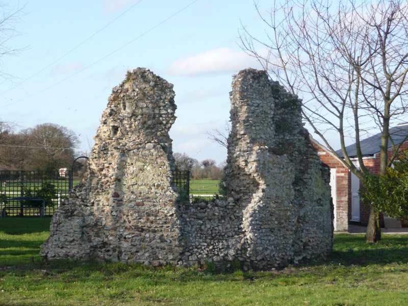
A 14.25 mile circular walk between Leiston to Dunwich
A simple walk using the Suffolk Coast Path from Sizewell to Dunwich with a visit to the ruins of the 12th century Leper Chapel. The return uses the the footpath via Mount Pleasant to get onto the Sandlings Path across Dunwich Heath to return back to Leiston.
An 8.4 mile circular walk around the Suffolk villages of Knodishall and Friston
An easy ramble across the Suffolk countryside, with the highlight being the hidden ruins of St Peters Church in the old parish of Buxlow, now a part of Knodishall. There's some fascinating history on this walk along paths that are off the beaten track but nonetheless well maintained.
Latest walk summaries are basic information sheets for walks that have yet to be fully documented. These provide links to maps, public transport and walks stats, although detailed notes and features are not included.