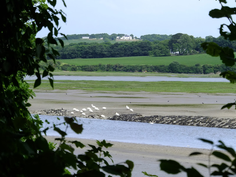
A short section of The Camel Trail route that follows the former North Cornwall Railway trackbed. This doubles up as both a cyclepath and a walkway making it suitable to virtually anyone of average fitness. The scenery is glorious as the track winds its way along the Camel estuary.
An 8.75 mile walk along the Angles Way from Wortwell to Earsham
It is not often that a country ramble coincides with a Brewery visit. On this route there are two, the historic St Peters brewery and the Waveney Brewing Company based at the Queens Head pub in Earsham. Although St Peters is a little off route a visit to this exquisite old building is thoroughly recommended. Also just off route is the village of Flixton where there is the remains of Flixton Priory and a church with a unique tower plus the setting for a spooky story.
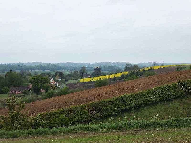
A 13 mile North Bedfordshire walk along the Ouse Valley Way between Oakley and Carlton taking in the charming villages of Pavenham, Sharnbrook, and Odell.
Although the Ouse Valley Way does not actually go into Oakley, there is a convenient bus stop here that links the two ends to this walk. The bus stop is a mile or so from the river, from where there is a footpath which joins the official route at Stevington and then winds its way through the rolling Bedfordshire countryside. There's plenty to see and explore along the route with medieval river bridges, the Holywell at Stevington, the ghostly tales of Odell and the picturesque villages of Pavenham, Radwell, Sharnbrook, and Harrold. Although many of the villages pubs have finally closed their doors for good in recent years, there are still convenient refreshment stops on route.
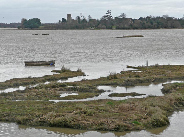
A 17 mile walk along the Angles Way from Diss to Harleston and onto Wortwell
There is plenty of history along this section of the Angles Way as it follows the course of the River Waveney. Numerous archaeological finds have been found along the route dating from prehistoric times through roman pottery and remnants of the middle ages. There are lost villages, halls and churches to provide ample opportunity for exploration as the path meanders across the Norfolk Suffolk border.
An easy and captivating walk along Norfolks River Bure
Not only does this walk provide some classic Norfolk scenery and historic features but it also traces the route said to be taken by the phantom carriage of Sir Thomas Boleyn in his annual act of penance for betraying his daughter Anne when she was sentenced to be executed. The walk is then made into a circular route by returning via the Bure Valley Path alongside the narrow gauge Bure Valley railway.
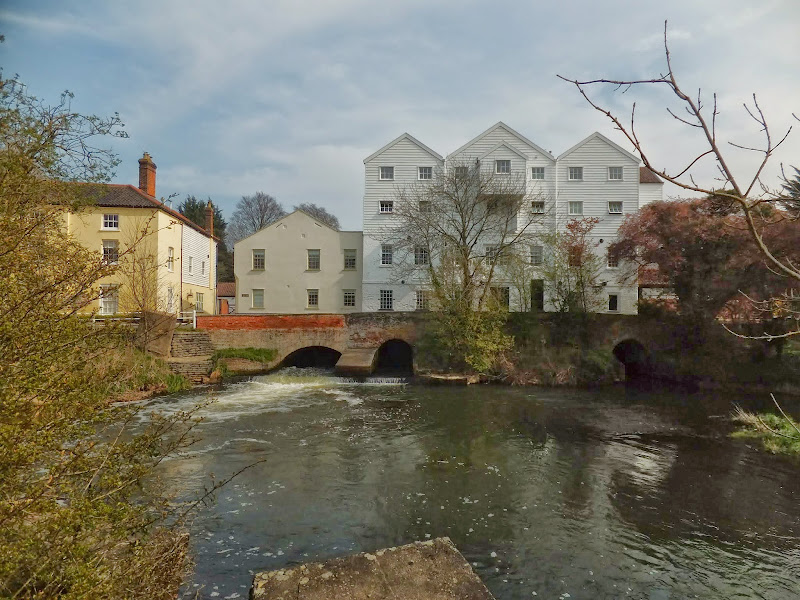
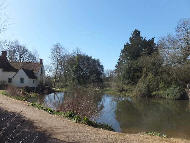
An 11 mile Walk along the River Stour incorporating sections of the Stour Valley Path, the Essex Way and St Edmund's Way
Flatford Mill is the idyllic English country scene encapsulated by John Constables renowned paintings including the instantly recognizable 'Haywain'. This circular route is an exceptional walk by all accounts and the perfect way to engross oneself in this landscape that sits on the Suffolk and Essex border.
A 14 mile walk along the Angles Way between Belton and Oulton Broad, crossing the border from Norfolk to Suffolk
The Angles Way roughly follows the River Waveney down to Oulton Broad from Belton although there are very few locations where the river can be viewed. Most of the route is across fields, along country lanes and through little bits of woodland. It is a pleasant full afternoons walk with a couple of pubs en route for refreshment. The main place of interest is Somerleyton, named after a peace loving Viking, Sumarlithi, who arrived in the 10th century. It is now a sleepy little village, famed for being the home to Christopher Cockerell, the inventor of the hovercraft, but more renowned for its connection with Gradabor, a giant who once ransacked the area. Some say his ghost still returns to re-enact this destruction.
A 7 mile circular walk along the Angles Way from Beccles to Geldeston Locks
A recommended short walk along the Angles Way to the outstanding Geldeston Locks pub, returning via the riverside path to Beccles. This walk passes the location of the historic Barsham Hall, source of the ghostly legend of Old Blunderhazard who is said to ride in his coach drawn by four fire breathing headless horses to Norwich and back each Christmas Eve.
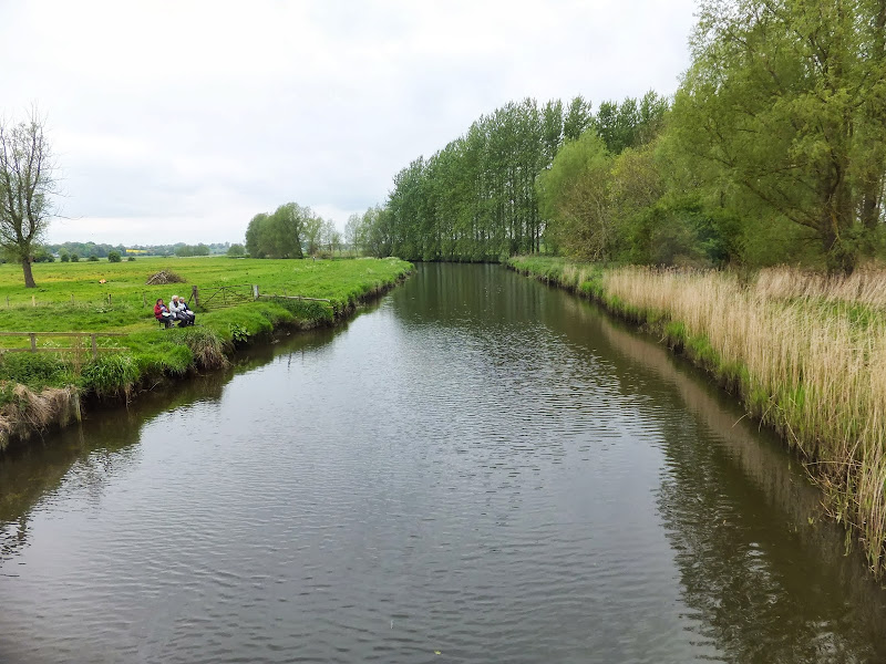
A 17 mile riverside walk along the Ouse Valley Way between Bedford and St Neots
Despite the increasing urbanisation between Bedord and St Neots, the riverside sections of this walk provide some pleasant rambles. Particularly notable is the 15th century river bridge at Great Barford and the riverside parks at St Neots.
A 15 mile walk following the River Nar from its outlet to the River Ouse up to Narborough
The walk starts along the quayside at Kings Lynn with all its fascinating historic buildings. The path soon heads out into open countryside following the river across this open landscape. Big skies. Views for miles and little in the way of civilisation until Narborough is reached.
A stroll along the southern side of the River Bure to the ancient hamlet of Heggatt
This short walk takes one through country lanes and along old tracks and footpaths on the southern side of the River Bure. Highlights include the ruins of Horstead Mill and views across the valley to Coltishall and Belaugh. Plus a walk would not be complete without a little piece of folklore, and this one is all about a prophesy centred around a tree on Heggatt Common
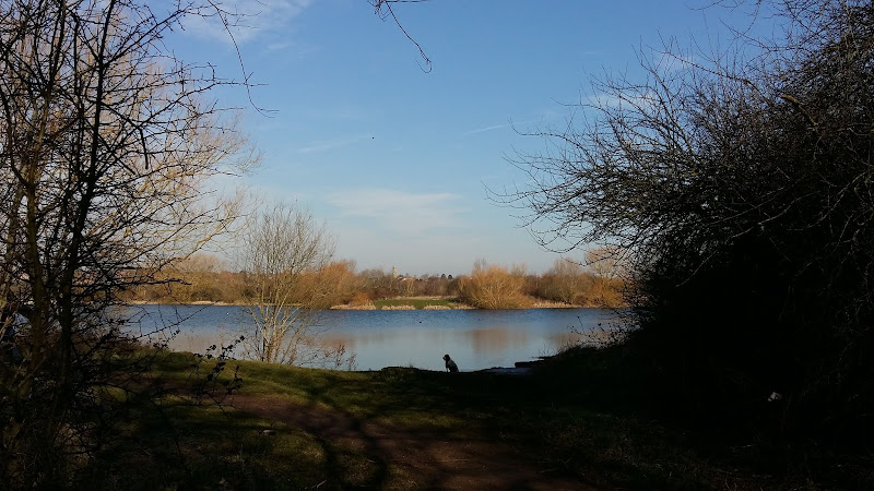
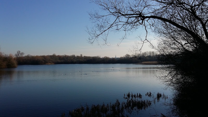
a 4.5 mile circular walk using well maintained footpaths through the Lakes nature reserve
An easy and pleasant ramble through the lakes area that occupies the Nene Valley in this part of Northamptonshire. Well maintained paths and tracks make this accessible for most folk and access into Higham enables one to break ones journey for refreshments with ample cafes and inns located in town.
On a Sunday morning, with the sun shining and a little warmth in the air one can witness the queues of traffic that wait to enter the hallowed avenues of the Rushden lakes shopping complex. The faithful patiently wait in turn to present their sacrifices to the Gods of consumerism in return for precious commodities.
It is a good feeling to leave this scene behind and get back to more natural surroundings. This walk starts at the roundabout just past the bus stop as one enters the shopping area. One needs to head behind the Decathlon store onto a path that initially appears to lead nowhere and looks to be nothing more than an access path to the rear of the store. Despite this, the path runs a short length alongside a wooden boarded fence then turns to access the lakes area. It is like a secret passage that any member of Enid Blytons Famous Five would discover on an adventure armed with the ubiquitous ginger beer and cucumber sandwiches.
Before the 1950s this area was all fields stretching out across the Nene Valley. Riverside meadows that were part of a flood plain which would regularly flood each winter. Things have changed drastically in the decades since, the whole valley from Northampton down to Ringstead is now pockmarked as a result of aggregate extraction, leaving numerous lakes of varying sizes. It is clear that mankind has had a huge impact on this area, changing the landscape irreparably. The result of this progress is a haven of nature with the diversity of wildlife and flora greatly expanded since the days of meadow and field, so I guess one can argue that progress is not all necessarily bad. Even the winter floods are now somewhat a thing of the past with the flow of water down the Nene valley better managed upstream.
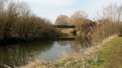
Bailey bridge across the River Nene
The well maintained path leads a straight course between Delta Pit lake on the left, and a series of lakes known as Wilson's Pits on the right. It is uncertain where the names are derived from but one assumes they are connected with the gravel extraction companies. Having said that, the area in Rushden on the Wellingborough Road adjacent to Adnitt Road was also known as Wilson's Pits, certainly from the 18th century onwards. This is honoured in the name of Wilson Road that runs along the western edge of the area. Whether there is any connection to the lakes area of the same name is unknown.
One soon comes to a bailey bridge across the main river. The humble River Nene. It flows from Badby to The Wash and is one of the principle water courses through Northamptonshire. One should note that the pronunciation of the river in these parts is Nen (rhyming with hen). This is Northamptonshire. It is called the Nen here. For countless generations it has and always will be the Nen. Even some old publications from the 19th century and earlier use the spelling of Nen. It is not until Peterborough that the name changes to the more upmarket sounding Nene (rhyming with been).
The bailey bridge was added as part of the rejuvenation of the area during the development of Rushden Lakes. There had previously been a bailey bridge here as part of the gravel extraction but that had long gone. The path then leads over another bridge that crosses a backwater that has now become the northern extremity to Higham Pits lakes, and onto the former Northampton and Peterborough railway trackbed. The line closed back in 1964 although the track was not lifted until the early 1970s and some freight used the line up until that point. I have memories of my dad proudly relating how he witnessed the Royal Train passing through the nearby Ditchford station although I cannot provide the exact time period for this event. Of course, Ditchford, for those who know the area, was famous for its treacle mines and some may say these very lakes are nothing to do with gravel extraction but are the result of centuries of treacle mining.
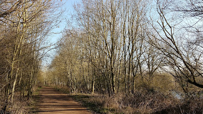
Former Northampton to Peterborough railway trackbed
These days it is difficult to determine that a railway once ran along these tracks such is the case that nature has firmly taken the trackbed over. Thick vegetation and trees cover either side of the well used path. There are occasional viewing areas where vistas across the lakes can be glimpsed with the town of Irthlingborough sitting across the way with its distinctive lantern towered church protruding above the rest of the buildings. The town is locally known as Artlenock, a name whose derivation is unknown. It has always been known as Artlenock around here and hopefully that tradition will continue.
Eventually the path comes to a cross roads of tracks where one needs to turn right and head into Higham, or Arm if one uses the local dialect. Once again, this is a well maintained pathway. Years ago it was nothing more than a footpath that connected Artlenock and Arm. This was a convenient route across the valley and I have many memories of using this path in days gone by when heading out to catch a band playing at the Bull in Irthlingborough then having to negotiate the way back in the dark. In winter it was not the best of paths and on many occasions one emerged back into Higham with shoes caked in mud and jeans equally splattered. These days it is a part of the Rushden Greenway, an urban path that links Rushden, Higham and Irthlingborough.
The track passes over the A45 trunk road by way of a large concrete footbridge bringing one into the extremities of Higham. There is then a steady 30m climb into the town passing through a sprawl of modern housing estates. Dont be fooled into thinking this path is a modern concoction designed to promote exercise for the urbanites who reside in these boxed dwellings. This is an old path, an old track that existed centuries before the mass expansion of these East Northamptonshire towns and villages.
The path leads out onto Saffron Road past the cemetery and the Recreation Ground which contains a pond known as Saffron Moat. The grassed area takes its name from the fields which were used to grow crocuses from which saffron could be farmed in medieval times. The moat also dates from this period and reputedly supplied the nearby Chichele college with fish.
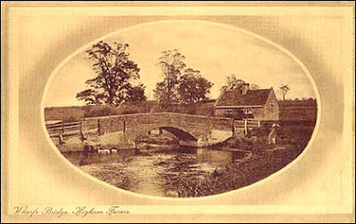
We return down Wharf Road to the river. In fact this is not the river any more, its course diverted when the Higham bypass was constructed. All that is left is a lake with a spur that was once the original course of the river. Gone is the single arched brick humpback bridge that provided access across the river and set a scene for many idyllic picture postcard views. The bridge has been replaced by rather grotesque metal structure that allows walkers and anglers access to the lakes area. Functional rather than aesthetic.
Once upon a time the Wharf would have been a busy trading place used to load and unload goods that were transported along river. No doubt the local brickworks that stood adjacent to the bridge up until 1915 made ample use of the Wharf. Long gone also is the Anchor Inn that once stood here to the right as one faces the bridge. This public house supplied travellers and locals with Dulleys ales from the Wellingborough brewery which was established in 1802 and lasted until it was taken over by Praeds brewers in 1920.
The coming of the railways spelt the end for the trade from Higham Wharf and the inn closed its doors during WWI although it is said they still offered non-alcoholic refreshments in the 1920s, no doubt to the locals who used the wharf for recreational purposes, swimming in summer and ice skating on the flooded meadows in winter. By the 1950s the building was derelict and now the area is nothing more than the end of a modern housing estate where a footpath follows the lakeside through the maintained parkland area.
Another concrete footbridge spans the A45 and there is a riverside path that leads back to the bailey bridge which one encountered earlier. This is all part of the Nene Way, a long distance trail that follows the full course of the river. We leave the Nene Way at the bailey bridge to return back along the path that the walk started out along to complete a very worthwhile ramble.
Short circular walk around the Skew Bridge Ski Lake
A very simple and easy walk along the footpaths around Skew Bridge Ski Lake. Situated on the edge of the Rushden Lakes shopping complex with restaurants and decking facing onto the lake, this trail circumnavigates the waters through the woodland that surrounds it. Wood based sculptures of a plethora of creatures can be found throughout. Any visitor to Rushden Lakes should take the opportunity to wander this trail.
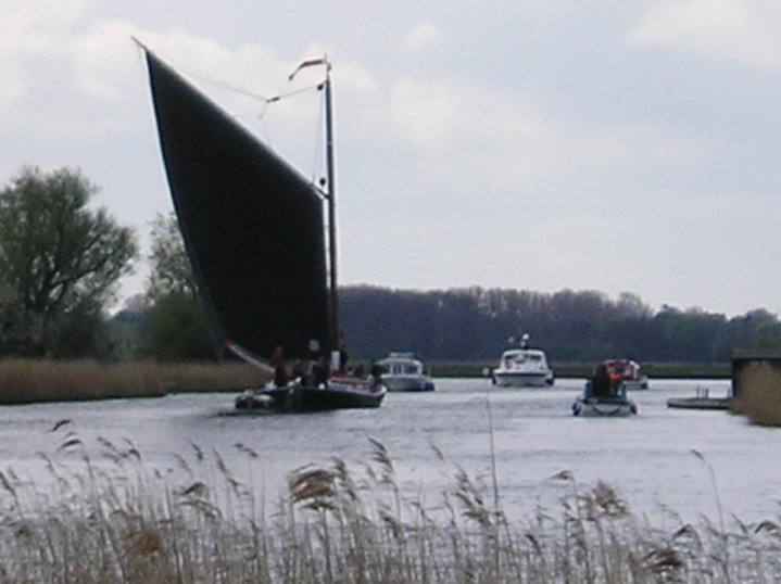
A 20 mile walk through the Norfolk Broads following the rivers Thurne and Bure from Potter Heigham to Great Yarmouth
A walk that follows the rivers Thurne and Bure down to the town on Acle. There is then some challenging navigation across Halvergate marshes to end up walking along the banks of Breydon Water into great Yarmouth. This really is the epitome of what everyone imagines of the Norfolk Broads. Broad open skies and large open flat landscapes.
A 12 mile walk along the Angles Way between Earsham and Beccles
The walk starts by heading up the hills that overlook Outney Common. This is a really rewarding start to an easy ramble that continues across the Waveney Valley to Mettingham before continuing down the Waveney Valley. Although Geldeston is on the opposite side of the river to The Angles Way the excursion across the Shipmeadow marshes is well worth the effort to visit the unique Geldeston Locks Inn.
A 13 mile walk along the River Deben in Suffolk, starting at Felixstowe and ending in Martlesham
The lovely walk along the Deben estuary. Although parts are inaccessible due to breaches of the flood banks, the mix of riverside paths, country lanes and footpaths provides an ideal mix of landscapes to keep any walker fascinated. The May bush pub offers a perfect place to take a rest and refreshment, its riverside location unbeatable.
An 18 mile walk down the Blyth Valley in Suffolk from Halesworth to Blythburgh, then across the heaths and commons to Leiston.
It was the legendary hell hound that supposedly came this way in 1577 and terrified parishioners of Blythbrugh church after doing a similar job at Bungay. This walk is in two sections, the first section follows the River Blyth along the Waveney Way to Blythburgh with the option to continue on to Southwold. The Waveney Way is a Ramblers Association walk and does not have waymarkers along the route. An optional second section cuts across to Westleton and onto Leiston. Both Southwold and Leiston have public transport links to Halesworth making the walk achievable as a linear route without the requirement of assistance of a taxi.
A 5.5 mile circular walk from Houghton to St Ives using the Ouse Valley Way
A simple and easy riverside walk following the course of the River Ouse. The walk uses the Ouse Valley Way to St Ives, returning via the picturesque Hemingford villages, full of thatched cottages and olde worlde charm. There's plenty of pubs, there's river locks, there's the iconic mill at Houghton which makes this a well worthwhile wander. Make a whole day of it and take in the sights and sounds and, of course, the quintessential English pubs.
A 7 mile walk along the Alde estuary, following the Suffolk Coast Path from Snape to Iken
There are disputes as to whether Iken is the land of Icanho that St Botolph was granted by King Ethelmund to build his minster in the 7th century. If it was then there were marsh demons in these parts during those time and one can still feel the eeriness of the area with the mysterious Yarn Hill where Botolph reputedly drove away the ghosts and marsh demons in order to build his minster. It was eventually completed on the site of the historic church at Iken which still bears his name. The church is a fascinating place to visit - be sure to spend a little time here and see St Botolphs stone cross which was unearthed in 1977 and is on display within the church.
A 15 mile walk from the Breckland end of the Angles Way to Diss
This is a picturesque ramble through the numerous fens that follow the course of the Little Ouse and The Waveney Rivers. Thelnetham Fen, Hinderclay Fen, and Redgrave and Lopham Fen are all managed wetlands with well kept paths and a variety of flora, fauna and wildlife. The path also passes through Wortham Ling, an area of managed common land that dates from medieval times. Even though the start of the walk at Knettishall Heath is difficult to get to using public transport, the walk is well worth the effort.
Latest walk summaries are basic information sheets for walks that have yet to be fully documented. These provide links to maps, public transport and walks stats, although detailed notes and features are not included.