The Peddars Way - Watton to Castle Acre
|
Thursday 24 February 2022
|
1 comment |
![]()

Watton to Castle Acre
A long and straight trail across lanes and tracks from Watton to Castle Acre.
|
Thursday 24 February 2022
|
1 comment |
![]()
A long and straight trail across lanes and tracks from Watton to Castle Acre.
|
Thursday 19 December 2019
|
No comments |
![]()
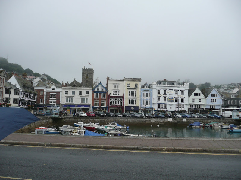
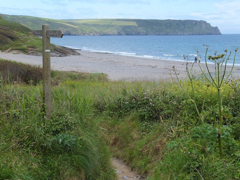
A 9 mile walk along the South West Coast Path between Dartmouth and Torcross.
This section of the walk starts at the deep water port of Dartmouth which is famed for where the second and third crusades departed in the 12th century. Across the River Dart is Kingswear, and down the estuary is Dartmouth Castle, built in the 15th Century. Passing the castle, the path heads round the coast and up to the village of Stoke Fleming, then meanders across the hills and lanes either side of the main Dartmouth road until it meets Strete. Here it descends down to Slapton Sands, which despite its name, is a shingle beach on one side and Slapton Ley, a natural freshwater lagoon, on the other. A simple walk with a few hills to negotiate and a bus service that links the two ends of the walk.
|
Wednesday 18 December 2019
|
1 comment |
![]()
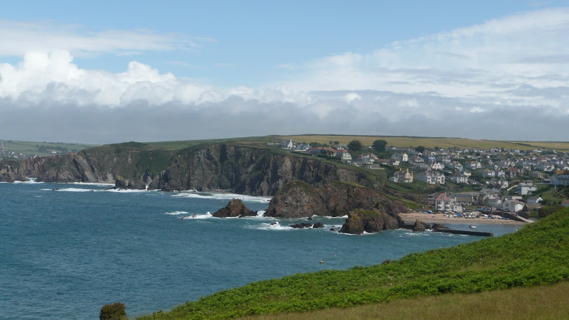
A 17 mile walk along the South West Coast Path between Churchstow and Salcombe.
This walk heads out from Churchstow through country lanes down to the South West Coast Path at Bantham on the Avon estuary. The Coast Path starts with easy walking along the low cliffs past Thurlestone and includes an 80 yard footbridge across South Milton Ley before it arrives at Hope Cove, a picturesque little fishing village. The section from Bolt Tail to Bolt Head is a little more strenuous with the path tracking up and down the cliffs and around a few craggy sections with steps built out of the stone. At Bolt Head the coast bears round to the north passing Sharp Tor which is cut out of the cliff-face, before it heads down into the pretty village of Salcombe.
|
|
No comments |
![]()
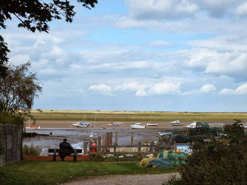
A 6 mile walk following the North Norfolk Coast Path between Burnham Overy Staithe to Brancaster
Wide open areas of marshland provide an enticing setting for this easy walk. Sailing boats, marsh, a tidal pool and the site of a Roman fort provide plenty of interest, together with three pubs, what more could one ask for of an afternoons stroll.
|
Tuesday 17 December 2019
|
No comments |
![]()
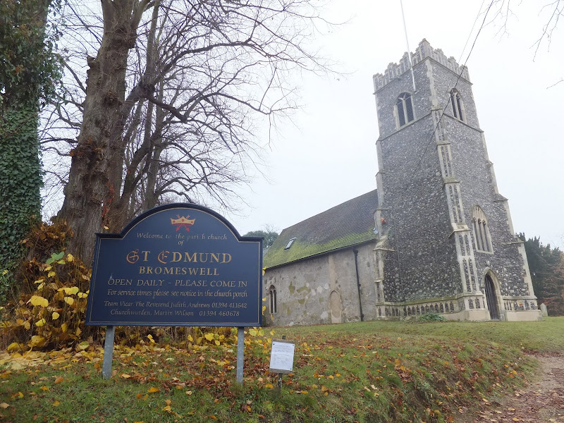
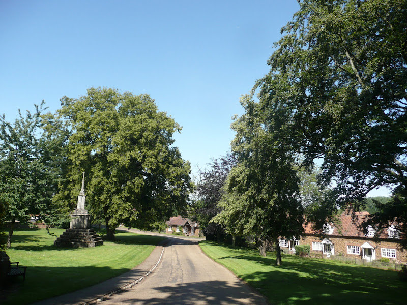
A very easy 2 mile walk around the Suffolk Village of Bromeswell
The Sandlings Path avoids the busy road between Melton and the footpath across the Heathland to Rendlesham Forest by navigating around the quiet village of Bromeswell. Although only a short distance, it is worth taking ones time to explore this quiet village with its typically East Anglian church of St Edmund.
|
Friday 6 December 2019
|
3 comments |
![]()
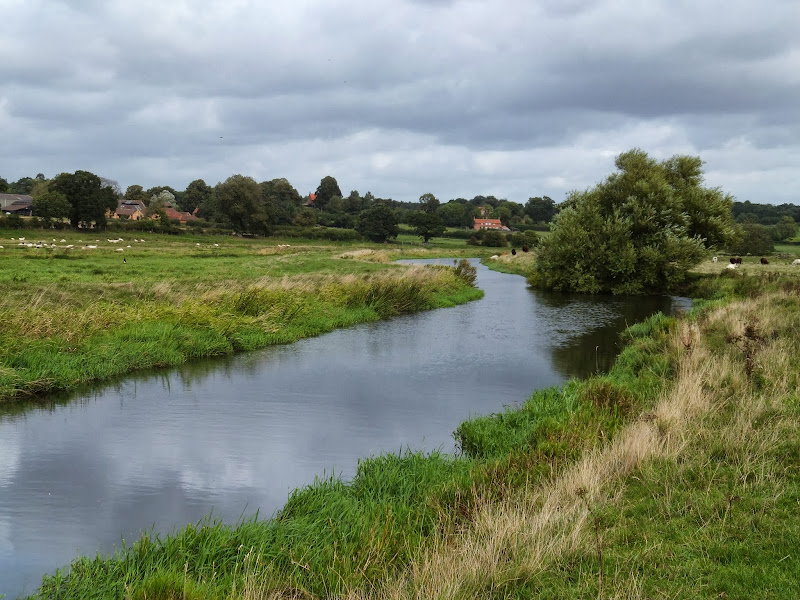
A 13 mile walk through the Norfolk countryside following the Wensum Way
Opened in 2012, the Wensum Way was the connecting link between the Nar Valley Way and The Marriott's Way to enable a Cross Norfolk Trail from Kings Lynn to Great Yarmouth. The name of the trail is taken from the River Wensum which it follows from Swanton Morley through to Lenwade. This is a picturesque ramble through the Norfolk countryside.
|
Tuesday 22 January 2019
|
No comments |
![]()
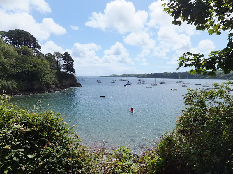
A 10 mile walk along the Cornish section of the South West Coast Path between Falmouth and the Helford Crossing
A picturesque walk following the coast on from the Fal estuary round to the Helford River where a ferry links the village of Helford. The views are spectacular throughout this moderately challenging walk and includes a glorious stroll across the pasture-land around Rosemullion Head.
|
Tuesday 8 January 2019
|
No comments |
![]()
A 20 mile walk along the Kings Lynn to Hunstanton section of the Iceni Way
There is no official footpath or right of way to walk the complete distance along the coast between Kings Lynn and Hunstanton. It can be done by navigating the defence banks and farm tracks and ignoring the odd 'No Access' sign. However, an alternative walk to link these two towns is to use the Iceni Way. This is a walk designated by the Ramblers using existing tracks and footpaths linking the interesting and scenic villages of Castle Rising, Sandringham and Dersingham before it navigates back to the shores of the Wash at Snettisham. With vast expanses of sand when the tide is out, this part of the coast is truly an awe-inspiring sight looking across towards Boston and Skegness. You can walk out for miles before the sea is reached.
|
Sunday 30 December 2018
|
No comments |
![]()
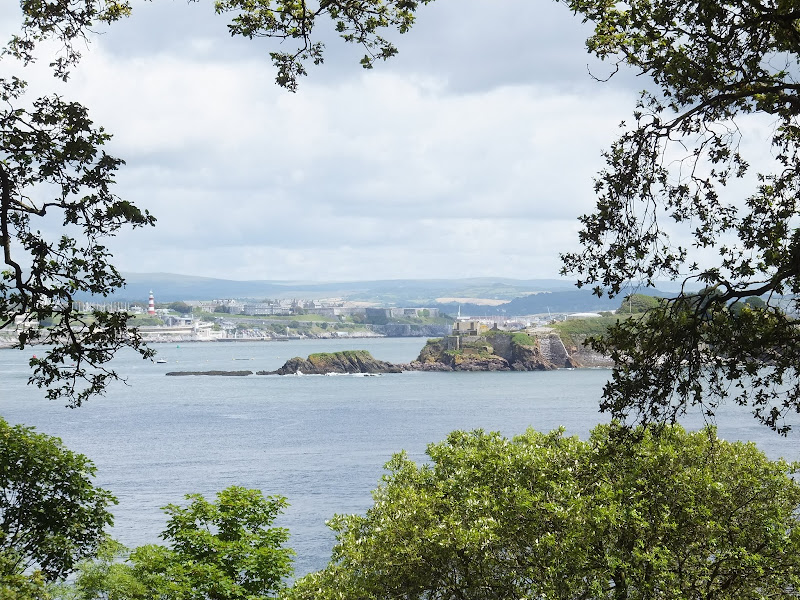
A 20.6 mile walk along the South West Coast Path between Looe and Plymouth.
This is the first section of the South Cornwall part of the South West Coast Path. There is a link between the two ends of the walk using the railways, changing at Liskeard. The walk is fairly easy in comparison with some sections of the South West Coast Path though it does have a few strenuous climbs. This particular walk misses out Rame Head in order to keep the distance down and allow connection of trains on the limited Sunday service.
|
Saturday 29 December 2018
|
No comments |
![]()
A 17 mile walk along the Cornish section of the South West Coast Path between Mevagissey and Porthscatho
This walk navigates along the Roseland Peninsular with diversions from the official Coast Path along country lanes. This provides a safer alternative for when the weather conditions are poor and the paths are slippery and visibility poor. This section of coastline has some remarkable scenery when the sun does shine and the paths are not too strenuous. The drawback is the lack of public transport between the two ends of the walk.
|
|
1 comment |
![]()

A 22 mile walk along the Nar Valley Way from Narborough to Dereham
This route is full of historic features including ruins of priories and castles as well as magnificent halls and watermills. The walk provides a varied landscape with woodland trails, riverside paths and saunters across open fields of this pleasant Norfolk countryside. Although a lengthy section of the Nar Valley Way there is plenty of time to accomplish the feat with late buses linking the two ends.
|
Wednesday 5 December 2018
|
No comments |
![]()
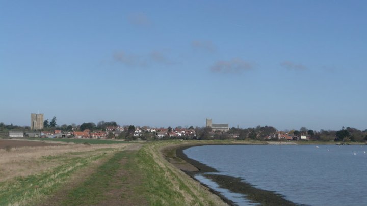
A 16 mile walk around the Orford Loop section of the Suffolk Coast Path
The main Suffolk Coast Path cuts through Tunstall Forest from Iken Cliff to Chillesford. However, more recently, a path has been added which allows access to Orford by following the Alde estuary. This then cuts back across Gedgrave marshes and Sudbourne Hall to return to the main path at Chillesford.
|
Saturday 27 October 2018
|
No comments |
![]()
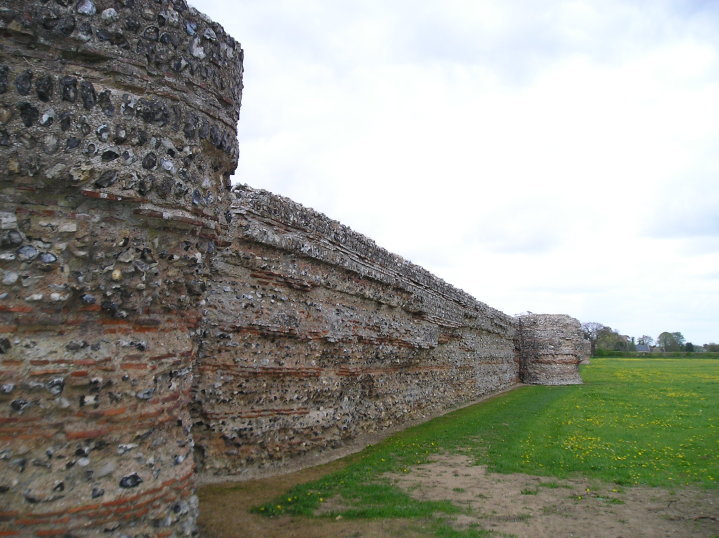
An 8 mile walk along the Angles Way from its start at Great Yarmouth to Belton
The Angles Ways journey begins with a walk along the banks of Breydon Water to Belton. Along this route can be seen the impressive remains of the Roman fort Gariannonum at Burgh Castle. This is a simple afternoons walk with a frequent bus service linking Great Yarmouth and Belton for the return journey. On this occasion we walked the path in reverse having set up camp at Belton.
|
Tuesday 31 July 2018
|
No comments |
![]()
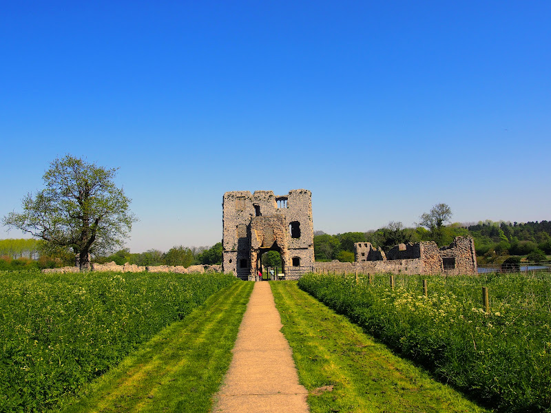
An easy walk to view the ruins of Baconsthorpe Castle with return route to Sheringham
The remarkable ruins of the moated and fortified 15th century manor house known as Baconsthorpe Castle lie to the south of the village of Bodham on the main A148 road close to Holt. Footpaths and lanes provide access through to this isolated wonder that lie hidden in the Norfolk landscape. The Castle is currently under the tenure of English Heritage and entry is totally free. The landscaped area is surrounded by a picturesque moat and information boards document the history of the ruin. This really is something worth visiting so allow at least an hour to peruse this piece of Norfolk history.
In order to get to the start of the walk, there is a frequent seven day a week bus service linking Sheringham and Bodham. After navigation to the ruins, the return is via the village of West Beckham where there is the Wheatsheaf pub for lunches and refreshment. A footpath leads down to the main road from where permissive paths through Sheringham Park provide an interesting and pleasant route through to Upper Sheringham. This route follows the parks Temple Walk and then continues onto Park Road to emerge back on the road at Upper Sheringham. The park is open from dawn to dusk and outside of these hours one is required to walk down the B1157 which has no pavement making a hazardous route, particularly during holiday periods.
There are pavements between Upper Sheringham and the main town and the walk ends at the bus stop adjacent to the North Norfolk Railway station.
A 10 mile walk following the southern side of the parish boundary of Leiston in Suffolk This walk follows the route of a 17th century peramb...


