Brittany - Huelgoat Explorer
|
Wednesday 16 February 2022
|
No comments |
![]()
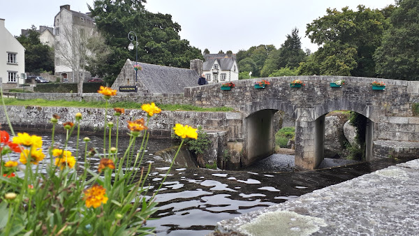
Brittany - Huelgoat Explorer
Ashort walk around Huelgoat, a commune in the Finistère department of Brittany in northwestern France
|
Wednesday 16 February 2022
|
No comments |
![]()
Ashort walk around Huelgoat, a commune in the Finistère department of Brittany in northwestern France
|
Wednesday 9 February 2022
|
No comments |
![]()

A walk along the North Wales Coast Path between Conwy and Llandudno
|
Monday 7 February 2022
|
No comments |
![]()

Circular walk with to give an essence of Offas Dyke trail
|
|
No comments |
![]()

Short town walk around Lowestoft
|
Sunday 6 February 2022
|
No comments |
![]()

A walk around the countryside of the Suffolk village of Peasenhall
|
|
No comments |
![]()

Exploring the countryside to the east of Halesworth
|
|
No comments |
![]()

Short walk round the headland known as Baggy Point
|
Saturday 5 February 2022
|
No comments |
![]()
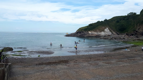
A short but strenuous walk across Hillsborough Hill that separates Ilfracombe and Hele Bay.
|
Monday 13 December 2021
|
No comments |
![]()
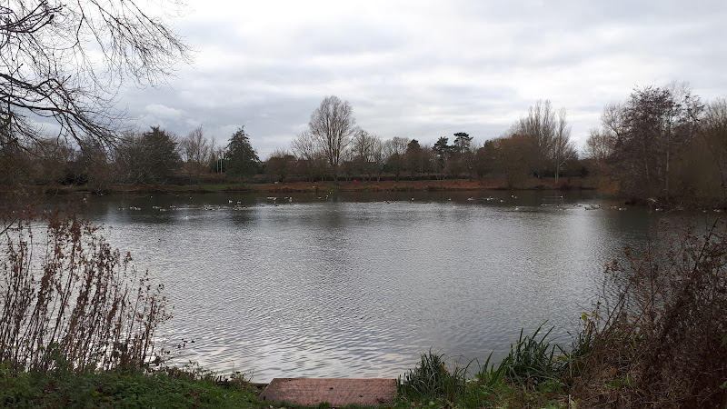
A simple circular walk around the Needham Market Lakes
A popular destination for many local people with plenty of well defined footpaths around the lakes and woodland. This walk includes an extension to the Alder Carr Farm tea shop for refreshments
|
Friday 26 March 2021
|
No comments |
![]()
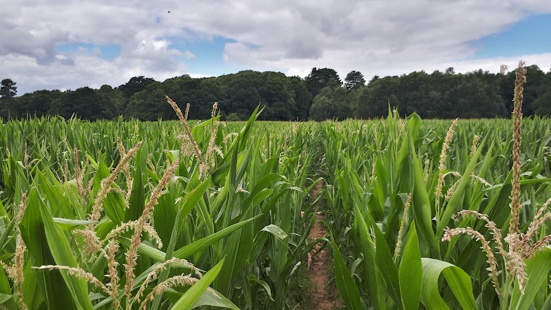
Short circular walk around heaths and woodlands of Foxhall, Ipswich
A pleasant stroll around the heaths and woodlands around Foxhall, to the east of Ipswich. The walk is short but nonetheless a pleasant way to while a way an hour or two. Natural woodland, babbling stream and if you look very carefully you may even see what remains of Foxhalls All Saints Church
|
Sunday 19 July 2020
|
No comments |
![]()
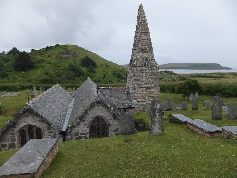
Short walk to St Endocs Church, buried in the sands of the coastal area close to Polzeath
The church of St Endoc is located in the coastal area close to the coast path alongside the Camel estuary. The church was buried in the shifting sands for some 300 years, being unearthed in the 19th century. Whether walking the coast path or visiting this area, the church is well worth a visit
|
|
No comments |
![]()
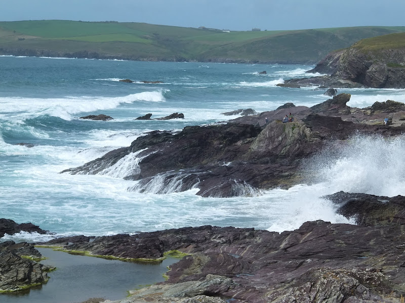
Short walk from Rock ferry to Polzeath along the Camel Estuary
A short section of the South West Coast Path that can be undertaken either as part of a more extensive hike or merely as a return ramble from Polzeath and across to Padstow. Fairly easy by SWCP standards and stunning scenery as is always the case with this Cornish coastline, and whilst taking all of this in one can contemplate the legendary Doom Bar that sits in the waters of the estuary.
|
Thursday 16 July 2020
|
No comments |
![]()
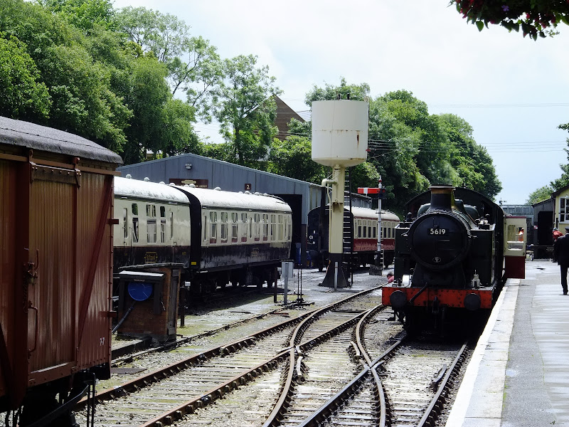
Route that connects the stations of Boscarne Junction and Bodmin General
A walk along the steam railway between Boscarne Junction and Bodmin General. Althoguh the path does not exclusively follow the railway it is nonetheless a pleasant walk for most of the distance with the attractions of the busy steam railway at Bodmin General station.
|
Wednesday 15 July 2020
|
No comments |
![]()
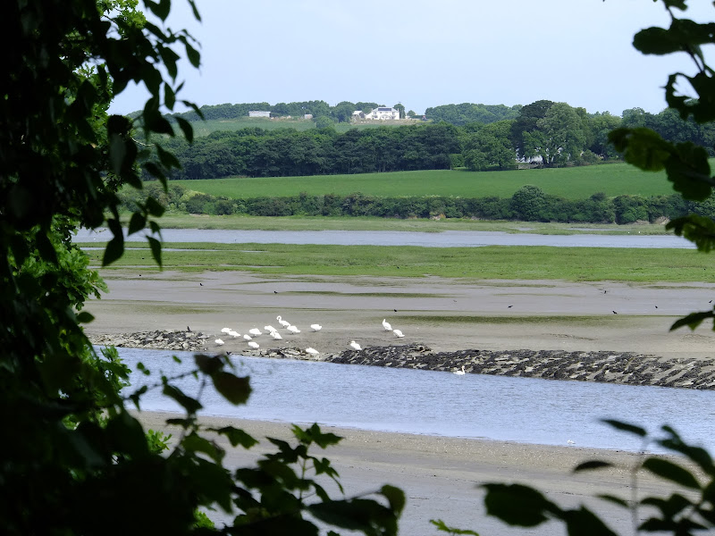
The Camel Trail - Wadebridge to Padstow
A short section of The Camel Trail route that follows the former North Cornwall Railway trackbed. This doubles up as both a cyclepath and a walkway making it suitable to virtually anyone of average fitness. The scenery is glorious as the track winds its way along the Camel estuary.
|
Thursday 19 December 2019
|
No comments |
![]()

A 6 mile beach walk to witness the damage caused by the 2013 Storm Surge at Cromer and Sheringham
Both Cromer and Sheringham bore the brunt of the storm surge on the night of December 5th 2013. Although repair work is well under way there are still the signs of what damage the sea can cause. There have also been many cliff falls along this length of coastline with the cliff faces providing a fascinating view sculptured by the weather and tides and offering multi coloured strata.
|
Wednesday 18 December 2019
|
2 comments |
![]()

A 4 mile beach walk to witness the damage caused by the 2013 Storm Surge along the shingle bank between Cley and Salthouse
The December 2013 Storm Surge caused widespread flooding of the marshes and sea defences along the North Norfolk Coast, resulting in the closure of the Coast path between Blakeney and Cley. It is still possible to walk out to the beach from Cley village via the road where a walk along the shingle will astound those who have walked this section prior to the December storm. The shingle ridge has been levelled, with the excess cast across the marshes.
|
|
2 comments |
![]()
The future of the 2.5 mile walk along the sea defences between Blakeney and Cley
The December 2013 Storm Surge caused major damage to the sea defences along the Norfolk Coast Path that encompasses the Blakeney Freshes. Work is currently being carried out to repair the breaches, however the long term future of both the Freshes and the coast path at this point is uncertain.
|
Tuesday 17 December 2019
|
No comments |
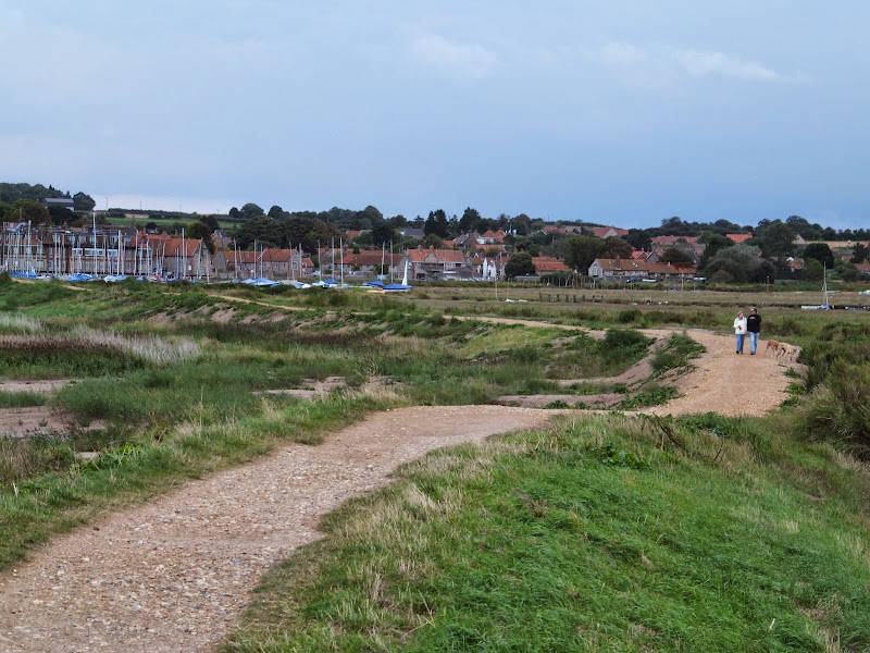
![]()
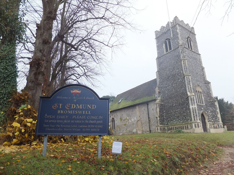
A very easy 2 mile walk around the Suffolk Village of Bromeswell
The Sandlings Path avoids the busy road between Melton and the footpath across the Heathland to Rendlesham Forest by navigating around the quiet village of Bromeswell. Although only a short distance, it is worth taking ones time to explore this quiet village with its typically East Anglian church of St Edmund.
|
|
No comments |
![]()
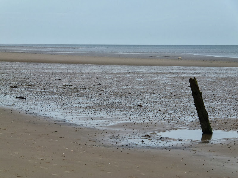
A 3 mile walk out to Brancaster Beach returning across the marsh to Titchwell
Although not included in the official Norfolk Coast Path route, this simple walk is a well worth excursion to witness the expanse of sand and dune as well as a petrified forest and an old wreck. Always be mindful of tide conditions and particularly do not attempt to get across to the wreck which lies across the Harbour channel.
|
Friday 6 December 2019
|
No comments |
![]()
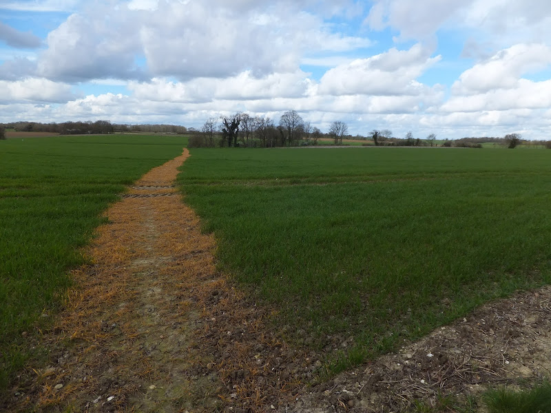
A 5 mile walk across the Coastal Suffolk landscape between Leiston and Saxmundham
This walk searches out footpaths to connect the neighbouring towns of Leiston and Suffolk. Although there is no direct route, the paths chosen are certainly more conducive to the walker than the busy road route. With the churches of Leiston and Knodishall on the route, plus the mysterious Harris's Pit in the parish of Sternfield there is enough to interest the avid rambler. Sternfield also has the notoriety of being the village from which the last woman to be burnt at the stake in England came.
A 10 mile walk following the southern side of the parish boundary of Leiston in Suffolk This walk follows the route of a 17th century peramb...


