Alton Water Reservoir Walk
|
Tuesday 10 December 2019
|
No comments |
![]()
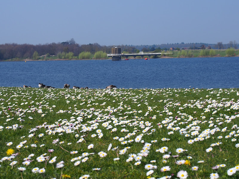
An 8 mile walk around Suffolk's Alton Water Reservoir
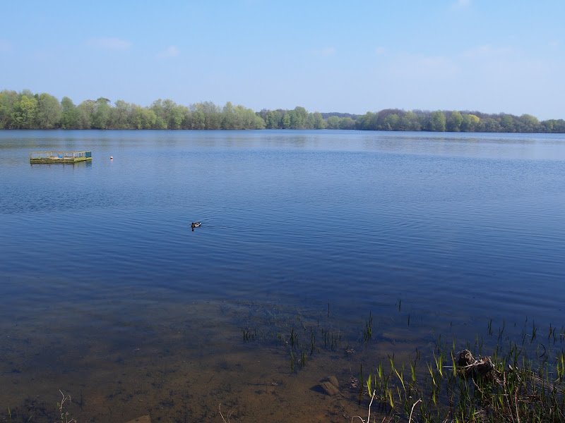
Located on the Shotley peninsular, the Alton Water Reservoir provides an easy walk around its water. A self contained circular route that needs little in the way of maps. Just keep the water on your left and keep walking! The mixed variety of landscapes of open meadow, woods and even the hills on the northern side of the reservoir provide a constant changing scenery throughout the walk.
Alton Water Reservoir Walk - Essential Information
Walk Statistics:
- Start location: Stutton
- Distance: miles ( km)
- Total Gain: ft ( metre)
- Total Descent: ft ( metre)
- Min Height: ft ( metre)
- Max Height: ft ( metre)
- Walk Time:
- Walk type: Circular
- Walk Grade: Easy
- Terrain: Footpaths, tracks with a small amount of road pavement across Lemons Hill Bridge
Maps:
The following maps and services can assist in navigating this route. There are links to printed maps and links to downloadable GPX route data for importing into navigational software and apps.
- Ordnance Survey Explorer Map
- OS Explorer 197 - Ipswich, Felixstowe & Harwich
- GPX Route File
Route Verification Details
- Date of Walk: 2017-04-08
- Walk Time: 10:30 to 14:30
- Walkers: Griffmonster, Kat
- Weather Conditions: Blue skies and warm spring day
Walk Notes
This walk has been written about in many resources and publications across the internet therefore I will not dwell on such aspects as the wildlife and the flora and fauna as this would only be reiterating what is already available. The walk route is very well publicised and this self contained eight mile circumnavigation of the reservoir provides a good afternoons wander which can be achieved without reference to maps. The south-west side of the reservoir is usually busy with many visitors taking a small walks along the asphalt paths that lead away from the main public car park, close to the village of Stutton. This is a pay and display car park and the method the majority of visitors use to visit the site. It is worth noting that there are alternatives to personal transport, principally provided by Ipswich Buses which has routes from Ipswich to Manningtree via Stutton (Service 92) and Ipswich to Colchester (Service 94) which passes through Tattingstone on the northern side of the reservoir.
As stated earlier there are asphalt paths leading away from the main car park and these make up the Easy Access Trail
, a 1.5 mile route that can be used by all, no matter what ability. The full circumnavigation goes beyond this trail and includes footpaths, tracks and a little road walking. There is one steep hill on the far side of the reservoir but nothing too challenging for the average walker.
It would appear that the vast majority of visitors navigate around the reservoir in a clockwise direction. Indeed this appears to be the direction most walking events at the reservoir employ and the information boards also appear to favour this direction. But why, an inquisitive visitor must ask, is such a direction favoured. Admittedly I am sure most visitors do not ask such a question, with the natural world, the weather and the scenery fully occupying their minds to such an extent that navigation directions are not even considered.
This question naturally provides a topic that most other resources do not dwell upon and which we can explore a little further. So first we shall ask a more fundamental question, why do the hands on a traditional clock-face revolve in what we have termed the clockwise direction, ie left to right. One possible suggestion is that this has been derived from the sun traversing the sky as viewed in the northern hemisphere. Facing south the sun will traverse east to west, left to right. Similarly horizontal sundials will have their shadow move from left to right. The opposite would be true in the southern hemisphere but as chronometer development appears to have evolved in the northern hemisphere then it is probably only natural that a clock would mimic the traversal of the suns shadow on a sundial.
Folklore appears to have latched onto this clockwise direction, providing warning tales of the consequences of circumnavigation of all sorts of features in the opposite direction. This is certainly predominant in East Anglia where numerous old tales will state that if one circles such artefacts as ancient stones and religious edifices in a counter clockwise direction, usually a specific number of times, then the devil will be summoned up and ask your business. Such examples include the druid stone in Bungay Churchyard and the churches at Swanton Morely and Westleton. The exercise is usually accompanied by an additional action such as a whistle or a touch of the stone which provides the impetus for the devil to appear. It is unclear why and from where such tales have originated. It may merely have been some childish game whose memory was carried through to adulthood and then passed onto the next generation. A dare around something sacred. I can certainly testify this is all it takes for a young mind to show off their courage as I can remember my brother doing just that at Bungay when he was told the tale. I note that nothing happened upon that occasion. Maybe this convention of a clockwise navigational route is from such notions that have been ingrained into the fabric of society over the centuries.
I have to admit that when it comes to navigating circular walks I will generally favour a clockwise direction, lest the devil appear I guess. In this instance it seemed only natural to choose this direction, there was no discussion or argument over the direction that should be taken, one put ones best foot forward, not forgetting ones second best foot, to find one heading in a clockwise direction.
There is nothing to stop anyone from leading an anti-clockwise route around the reservoir and I am sure the anarchist in some individuals would surely do this as a sign of breaking out from the repression of both custom and Anglian Waters preferred walking directions. Indeed, on this visit we did pass a few folk walking in the opposite direction. Anarchists? Maybe not. Scientists? Maybe. Maybe they were testing the hypothesis that walking in a counter clockwise direction would result in a confrontation with a demonic entity. However the car park where most folk started and ended their perambulations was distinctly absent of any demons so I would conclude that their experiment resulted in failure, just as my brothers careless abandon produced at Bungay. The end point did have a shop though, where a cup of tea and scones could be purchased.
In all this is a great walk with some pleasing panoramas and ever changing views of the reservoir. Refreshments can be purchased at the shop by the Stutton car park. There is a pub off route at Tattingstone, where following the road after traversing the Lemons Hill bridge will bring one to the The White Horse Inn.

Directions
Easy circumnavigation of the Alton Water reservoir
The path is easy to find from the Stutton car park. Follow the paved path to the left of the buildings. There are other little footpaths closer to the waters edge which can be used. The path leads through Larch wood to emerge close to the Tattingstone Wonder, a folly that appears to be a church tower. Follow the road around a sharp right hand bend, then where it turns left a footpath leads back down to the waters edge. Keep to the footpath until it emerges at Lemons Hill bridge.
Cross the bridge, then take the path on the right. Keep to this path ignoring all other paths leading off from it. This will follow the small creeks along the north side of the reservoir. Eventually it will emerge at the dam, where a path leads across to the meadows and car parks on the Stutton side.
Features
History of the Alton Water ReservoirView in OS Map | View in Google Map
The Alton Water Reservoir came into existence due to the expected demand for water in the Southern Suffolk area heading into the 21st century. It was clear even in the 1960s that there would be insufficient water resource to service the ever growing population of the area and a solution was sought. Twenty candidate sites were drawn up including the Belstead Brook valley south of Ipswich, the Mill River Valley in the Foxhall and Bucklesham area but it was the Tattingstone valley that was eventually considered to have the best conditions to support such a reservoir.
Construction on the project began in 1974. A 65ft high dam across the valley that carried the Tattingstone Brook was constructed from local London clay. This would result in a body of water of some 600 acres in area with a maximum depth of 60ft and holding 3,000 million gallons which would accumulate over the following 13 years from water pumped up from the River Gipping as well as the natural aquifers that bore the Tattingstone Brook.
Such a project would not be without consequence and although the valley was sparsely populated it nonetheless held some historic buildings, notably a 17th century manor house known as Alton Hall, the 16th century Tattingstone Hall Farm and the Alton Watermill, also known as Stutton Mill, which was built at the turn of the 19th century and whose millhouse dated from 1765. All of these would become submerged and in addition some 75 people would lose their homes.
Despite any objections the proect went ahead and both Alton Hall and Tattingstone Hall were demolished prior to the flooding of the valley. However, Alton Mill gained a reprieve and was dismantled brick nby brick to be moved to the Museum of East Anglian Life at Stowmarket where it still stands today.
References

Gallery
Below are a selection of images taken from from the photo album for this walk. Feel free to browse through these or click on an image to view a larger version in the Gallery.


Summary of Document Changes
Last Updated: 2021-12-12


0 comments:
Post a Comment