Saxmundham, Kelsale and Carlton Circular Walk
|
Monday 17 December 2018
|
No comments |
![]()
A 4 mile walk around Saxmundham, Kelsale and Carlton
Using footpaths an country lanes, this short walk provides some fine views, historic churches and even a ghostly tale of an apparition of phantom dancers. A worthy candidate for an afternoons exploration of this hidden corner of East Suffolk.
Saxmundham, Kelsale and Carlton Circular Walk - Essential Information
Walk Statistics:
- Start location: Saxmundham
- Distance: miles ( km)
- Total Gain: ft ( metre)
- Total Descent: ft ( metre)
- Min Height: ft ( metre)
- Max Height: ft ( metre)
- Walk Time:
- Walk type: Circular
- Walk Grade: Easy walking
- Terrain: Quiet lanes and footpaths
Maps:
The following maps and services can assist in navigating this route. There are links to printed maps and links to downloadable GPX route data for importing into navigational software and apps.
- Ordnance Survey Explorer Map
- OS Explorer 212 - Woodbridge & Saxmundham
- GPX Route File
Route Verification Details
- Date of Walk: 2014-11-08
- Walk Time: 11:30 to 14:30
- Walkers: Griffmonster, Kat
- Weather Conditions: Bright and sunny autumn day with increasing cloud as the day went on
Walk Notes
It is true that being British one is obsessed with the weather. It was the weather forecast that had stated all week that the Saturday would be a wash out with heavy rain and high winds coming in from the south-west. Maybe that is why on the Friday evening an extra pint of ale was consumed with the thought of no immediate need to arise at the usual hour the following day. After all it would be better to stay tucked up in bed on such a weather weary morning. An extra pint of ale is usually the harbinger of a hazy head and this was definitely the case on the following morning. Shorts Farm Indie IPA is a most robust and worthy drink but was most definitely the cause of why my somewhat hazy mind could not fully comprehend was the scene from the window on that supposedly wet morning. Blue Sky. Bright golden sunshine. That took a few minutes to really sink in. This scene was also the precursor to redefining the plans of the day, and a hastily revised schedule to head off for a short walk to investigate a recently read ghost story.
The Kelsale and Carlton circular walk had been completed before but it is always worth while revisiting a walk as there is always something new to see. What had prompted this particular instance was the ghostly story that had been found in an old book picked up from a charity shop a few weeks previous. Entitled Haunted East Anglia and written by Joan Forman this had a chapter devoted to each of East Anglia's counties, and each county containing testimony from first hand witnesses of strange phenomenon. The Suffolk chapter was especially interesting as it featured the encounter with a ghostly vision of phantom dancers that had occurred on the very path that this particular walk takes back onto Saxmundham. Although such an encounter would most likely not occur again it is nonetheless worthy of rewalking this path just to soak up the atmosphere and take it all in from the witnesses point of view. The only sad thing about the specific location of the encounter was that the area had been turned into a modern housing estate and therefore one would not be able to see across the meadows where the sighting had originally taken place. Maybe one of the houses contained haunting visions. Maybe, the vacant plot of land where the footpath emerges onto Henley Close was the site of the phantoms and no one had dared build on this for fear of disturbing the unknown. It does seem curious that on this modern housing estate there is the one vacant plot between the more modern houses and the somewhat older houses that now sit in front of the new school although none of this would have been there at the time on the sighting. Who knows. Read the full story in the features for this walk. It is a most curious tale.
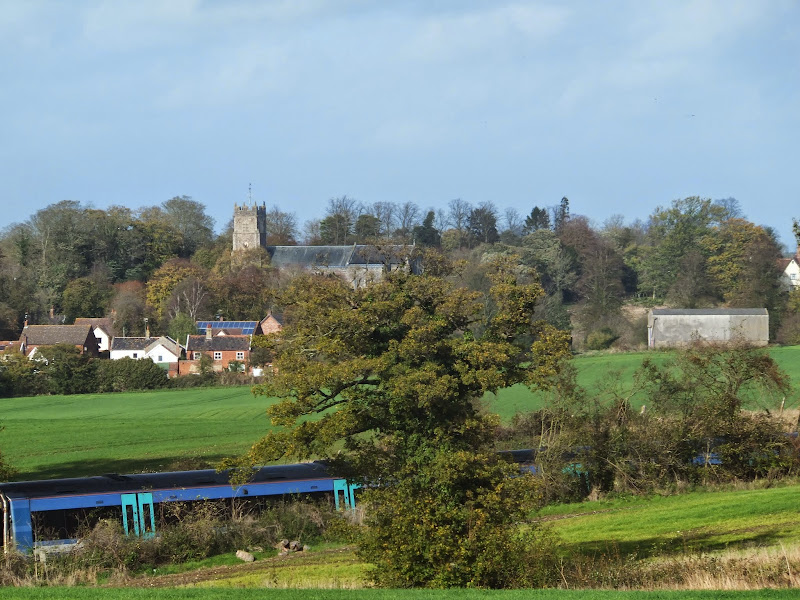
The spooky part of the walk is at the end so this detail is all a bit backwards and what should not be passed over is the walk itself as it is a worthy ramble by any standards. The start of the walk heads up onto the higher ground east of Saxmundham. From here the distinctive towers of Skouldings Mill and Kelsale church are ever present marking the route of the walk.
Kelsale is a hidden gem of a village. Off the main road and thus quiet and undisturbed. There are notable old buildings including the Old Guildhall which dates from 1495. The church at Kelsale should definitely not be missed out. There are free notes at hand to guide one around the various features of this thousand year old monument. It is interesting to note that the church boasted 6 bells in the early 19th century and consequently the local pub was named The Six Bells. Then in 1831 they added another two bells. The pub closed down and the building opposite took on the role as the pub and it was named The Eight Bells. The first six bells appear to have been installed at various other times, the first being in 1425. One cant help but wonder whether at the time they opened up a hostelry and named it the Bell, then in 1681 when the second bell was installed whether the pub closed and another opened called the Two Bells. There certainly isn't any evidence of this although it is an interesting avenue of thought. Unfortunately, although the church bells still exist, all of the Kelsale pubs have long closed their doors to the public. Maybe we should petition for another bell to be placed in the tower in the hope it will spark the addition to a new pub named The Nine Bells. Or, to save the expense of bell casting and installation, maybe we should amend the petition to install a simple gong rather than a bell with the expectation of a pub opening under the name of The Eight Bells and a Gong.
Beyond Kelsale is Carlton. Skouldings Mill is seen on the road to the Poachers Pocket pub where it is worth stopping for a bite of food and refreshment. The farmland that lies to the right is said to be the location of Whit Cross where a suicide burial was reported to have occurred in 1733. The return then follows the Gull Stream to Carlton church with views across Carlton Park to the Hall. Beyond Carlton Park the walk follows the public right of way through the modern housing estate. This crosses the main road through the estate and on the right is the school which is thought to have been the approximate location of the ghostly dancers that were witnessed in the early 20th century.

Directions
The outbound route follows the East Suffolk Line path. Return uses quiet lanes through to Kelsale and Carlton followed by a footpath back to Saxmundham
Take the footpath that leads down the side of the railway bridge on the north side of Saxmundham and is marked with the East Suffolk Line Path waymarker. Keep to this path until the railway line junctions with the Sizewell branch. At this point a footpath leads across the tracks then across the fields to a country lane. Turn right for a couple of hundred yards and another footpath on the left takes you across more fields to the Kelsale road. Turn left and follow the road into Kelsale - this is a quiet country lane with little traffic. Continue down into the village and turn right onto Dennys Lane which leads up to the church.
Return from the church down Church Lane and turn right at the junction. Continue through the village up to the main road, cross straight over and head up the Rosemary Lane towards Carlton. Pass Skouldings Mill and follow the road around the double bends. The Poachers Pocket pub is on the left around the sharp left bend at the top of the road.
Keep to the road and cross directly over at the junction to follow a track. This slowly descends and then passes over Gull Stream, a small brook. Take the footpath on the left that follows the stream. Keep to this which joins a track that then leads across a meadow to Carlton Church. Follow the path around the edge of the churchyard and then continue over to the hedgerow. Go straight through and head to the left of the play fenced area keeping in a straight line towards the woodland directly ahead. The path leads through the trees and then out onto the housing estate. Walk down Dove Close, cross the road at the junction and folow the footpath down the side of the school. This emerges onto Henley Close. Turn left and follow the road which bends round to the left then the right. A footpath on the left cuts through to Harpers Lane which leads down to the main road. Turn right to return to the starting point.

Pubs
Poachers Pocket, Carlton View in OS Map | View in Google Map

- Address
- Rosemary Lane, Carlton
Formerly known as The New Inn, this 19th century pub offers a good range of food with ales from Adnams and Greene King. Friendly family run establishment that is popular with both locals and visitors using the local caravan park.
A lively lunchtime with diners and drinkers in this welcoming hostelry. With the choice of Adnams Southwod Bitter and Old Ale, Green King Abbot Ale the choice of preference was definitely the Old Ale. Dark but not overpowering and easy drinking with more nutty rather than chocolate overtones. Mild, certainly not a stout. This was a good accompaniment to the cheese and onion baguette that was ordered. It did take time to arrive but that is probably because it wasn't a simple baguette but complete with chips and salad and well filling.

Features
The Church of St Mary and St Peter, KelsaleView in OS Map | View in Google Map
It is unknown when the church got its twin dedication. Certainly during the mid-to-late 19th century it was known as plain St Marys as evidenced by old books and OS maps of the time. One may guess that the merging of the parishes of Carlton and Kelsale combined the dedication but for the fact that St Peters church still exists in Carlton and is a going concern.
On walking up Dennys Lane the first thing that catches the eye is the distinctive Lych Gate which was designed by E.S. Prior, an architect who was instrumental in establishing the arts and crafts movement, during the latter years of the 19th century. The church itself is thought to be at least a thousand years old with mention of it in the Domesday Book of 1086. It has an unusual western tower which was placed in this position due to the construction of a large nave to the north of the existing church in the 14th century. Additions of the south porch occurred in the 15th century and a reading room was added in the 19th century.
Inside, behind the font, is a decorated screen, known as a reredos. This was originally placed behind the altar in the 1870's but had to be moved as it cut out the natural light from the east window.
The church tower houses eight bells, two of which were added in 1831 when a new clock was installed. This addition was reflected in the names of the local public houses. The Six Bells, although now long gone, used to be located just down the road and the present house still retains this name. The pub was said to have been located where the present garage is and the cellar steps still remain although the cellar itself has been filled in.
Shortly after the church added two new bells, the Six Bells pub closed and another opened across the road with the name of The Eight Bells. The Eight Bells finally closed its doors in 1986 although the building still remains, and is named Bell House.
References
Skoulding's MillView in OS Map | View in Google Map
Located on Rosemary Lane in Carlton is the seven storey former windmill known as Skouldings Mill after Thomas Skoulding who commissioned the structure in 1856. The mill was built by millwright John Whitmore of Wickham Market and comprised of four patent sails to drive three pairs of millstones. The lower two storeys were tarred and the remaining brickwork was painted white. The whole structure was topped with an ogee cap and gallery and a fantail.
The mill lost its sails during a gale on January 18th 1891 and in 1905 it was converted from wind to a steam which drove a rolling mill. The cap was removed in the 1950's after which the machinery was removed and the building converted into a residential property which continues to this day.
References
Roadside BurialView in OS Map | View in Google Map
Back in the 18th century it was common practice to bury suicides at cross roads on the edge of the parish boundary with a stake driven through their body. One such burial was recorded in the parish records of Kelsale in the year of 1733, which states "Robert Balls at the white cross [a crossroad on the parish boundary] was buried February 4th"
The heritage Suffolk website has recorded this as a suicide and places the site of burial with a grid reference of TM 38 65. Both modern and 19th century OS maps do not depict a district of White Cross in the Carlton cum Kelsale area, and there is no indication within the website page as to how this particular spot was determined other than a reference to a publication known as The Folklore Journal (Halliday R,Roadside Burial of Suicides: An East Anglian Study, Folklore 121, April 2010). The specified location can be found by following the footpath north of Skouldings Mill that leads to an area known as Curlew Green. The grave is supposed to be to the left of this footpath and which, these days, is nothing more than arable farmland. There is certainly no indication of there ever having been a cross between two rights of way as one would expect.
It is interesting to note that in Kelsale Church, on the roll of honour it lists a Jack Woodward whose parents are credited as living at White Cross Gardens, Carlton. Such a place no longer appears to exist and despite asking locals there appears to be no memory of such a location.
References
St Peters Church, CarltonView in OS Map | View in Google Map
Probably the most curious thing about St Peters church is its location. It is placed in the middle of Carlton Park with no road access and only footpaths leading to it. The church is not served with electricity and all services have to be held either in daylight hours or, on special occasions, with candlelight.
The structure is a small flint and stone building, probably dating from the 14th century, with a brick tower that was added two centuries later. Old OS maps also link a rectory to this church although there appears no sign of this today. The rectory is also referenced in the 1855 publication of History, Gazetteer and Directory of Suffolk which also expands on the subject by listing that some time around the year 1330 John Framlingham, the then rector of Kelsale, founded a chantry here for three chaplains to pray for the soul of Alice, the first wife of Thomas de Brotherton, Earl of Norfolk. Simon Knott who maintains the Suffolk Churches website speculates that the 15th Century choir stalls may be relics from the old chantry.
Although the church is still in use, its structure is not in the best of upkeep and it is not open to the public although the graveyard is well maintained and is still in use.
References
Tale of the Ghostly DancersView in OS Map | View in Google Map
From Carlton Park there is an old right of way that leads through to Harpers Lane on the north side of Saxmundham. Recent times have seen development of much of this area with housing but the right of way still exists. It was along this old footpath that the dancing ghosts of Saxmundham were witnessed in the early part of the 20th century. The story is told by a Mr B Waterman, who along with his brother, grew up in the town. They were not even in their teens at the time of the sighting and had set out one morning to go and play up at Carlton Park. They followed Harpers Lane and just past some stables a sight had them come to an abrupt halt. There, about 30 yards away in a meadow, were a group of figures, seven or eight in number and each one dressed from head to foot in a white luminous muslin garment which hid their faces. These figures appeared to be dancing in a circle with natural rhythmic movements although there was no music or sound to be heard. Just the figures rhythmically dancing in a follow-the-leader style. After a few seconds they just disappeared. Vanished into thin air. Both the brothers had witnessed it and without discussion, they fled back down the lane.
The story was recorded by Joan Forman in her book entitled Haunted East Anglia which was published in 1974 and the details taken from an interview with the witness who, at the time, was living in Ipswich. The story is vouched by both of the brothers and the details are the same and have remained with both brothers for the whole of their lives.
The event is said to have taken place in the area of The Bottle and Glass pub. This has long since gone but it is depicted on the 1837 OS Map although by 1881 its reference was removed. Mr Waterman attests that the family later moved to the building, so clearly it still existed in the early 20th century. The maps scale is not sufficient to be able to give a definitive position but it would appear to be located alongside an unnamed stream that leads down to the River Fromus.
The manifestation appears to have been a one-off incident for there are no other recorded reports of such sightings around Saxmundham. This particular area also has no reported folklore attached to it and there are no historic events or buildings connected with the land. Fairfield House, the only notable building, stands to the east of the location and was constructed in 1828 but there is no evidence of any earlier occupation of this land other than a find of a silver halfcrown coin, dated from the times of Charles I (1644–45), in the garden of a house on Felsham Rise and the discovery of several items of Saxon origin that were discovered during the construction of the Saxmundham bypass, to the west of this area.
Today the area is occupied by the Brook Farm housing estate which was built in the early 21st century. It is interesting to note that the right of way from Harpers Lane leads down the side of a school on this development. By the side of the school is a small stream which is the same watercourse depicted on the 1837 map where the Bottle and Glass pub stood. The school buildings are immediately beside the path and beyond them to the west are playing fields. Could this be the location of the ghostly sighting? Could this have been a curious glimpse to the future and the dancers were school children? That is a huge leap of speculation.
References

Gallery
Below are a selection of images taken from from the photo album for this walk. Feel free to browse through these or click on an image to view a larger version in the Gallery.


Summary of Document Changes
Last Updated: 2021-12-07
Distance:Short, East Suffolk Line Path, Features:Churches and abbeys, Features:Folklore, Features:Mills, full-detail, Ghost Walk, OSmap:212, Suffolk


0 comments:
Post a Comment