Winterton to Great Yarmouth Beach Walk
|
Wednesday 21 November 2018
|
No comments |
![]()
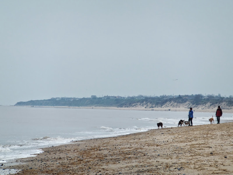
A 9 mile beach walk between along the Norfolk coast from Winterton to Great Yarmouth
This walk is probably better known as Robinson Crusoe's walk since this is where Daniel Defoe places his character, in the novel of the same name, after being shipwrecked with a resulting walk to Great Yarmouth. Although such a stormy day would not make the best of walks, when the sun shines and the tide is out this really is a great walk.
Winterton to Great Yarmouth Beach Walk - Essential Information
Walk Statistics:
- Start location: Winterton
- End location: Great Yarmouth
- Distance: miles ( km)
- Total Gain: ft ( metre)
- Total Descent: ft ( metre)
- Min Height: ft ( metre)
- Max Height: ft ( metre)
- Walk Time:
- Walk type: Linear
- Walk Grade: Easy beach walk across firm sand
- Terrain: Firm Sandy Beach throughout
Maps:
The following maps and services can assist in navigating this route. There are links to printed maps and links to downloadable GPX route data for importing into navigational software and apps.
- Ordnance Survey Explorer Map
- OS Explorer OL40 - The Broads
- GPX Route File
Transport:
Details of public transport that is required for the walk
First Group - Bus Service
- Service Details
- 1 - First Group 1 service linking Lowestoft, Great Yarmouth, Caister, Hemsby and Winterton
- Timetable
- First Group (Norfolk and Suffolk) Website
Route Verification Details
- Date of Walk: 2014-04-12
- Walk Time: 11:00 to 15:30
- Walkers: Griffmonster, Kat
- Weather Conditions: Overcast
Walk Notes
A Warning
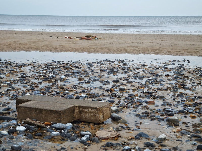
It must be stressed before reading any further that tide times need to be consulted before attempting this beach walk. Although there is easy access to the dunes throughout it must be noted that certain high tides can cover the beach up to the sea defences. Throughout the route there are alternative paths through the dunes and the tracks behind them.
The Beach Walk
Public transport linking the ends of this walk is provided by the number one service that runs between Great Yarmouth and Hemsby and Winterton. On this occasion we had arrived at Lowestoft, the starting point for the service, about five minutes early. The preceding number one service had broken down with a fuel leak and therefore we managed to get its replacement although this only went as far as Hemsby as Winterton is only served by every other service. This is not a problem as there is a worthwhile half hour walk through what is known as The Valley between Hemsby and Winterton. This is a pleasant amble across the dunes that front the coast bewteen the two villages.
As stated in the introduction to this walk, this really is the Robinson Crusoe walk. Robinson Crusoe was the fictional creation of Daniel Defoe, although some say the character was based on a real life person. The original title of Defoes famous novel was 'The Life and Strange Surprising Adventures of Robinson Crusoe, Of York, Mariner: Who lived Eight and Twenty Years, all alone in an un-inhabited Island on the Coast of America, near the Mouth of the Great River of Oroonoque; Having been cast on Shore by Shipwreck, wherein all the Men perished but himself. With An Account how he was at last as strangely deliver'd by Pyrates.' It was first published 1719 and subsequently the title was shortened to the more familiar 'Adventures of Robinson Crusoe'. Early on in the plot Crusoe is on board a ship from Hull which encounters a storm off of Winterton Ness where the ship is wrecked. He manages to escape to shore in a rowing boat, forcing him to walk the distance along the beach to Great Yarmouth, the same route as this walk.
The sandbanks around this coastline presented a treacherous obstacle for shipping in those days. With todays modern navigation the passage along this coastline is a lot safer and storms are more of a threat to the actual coastline, leaving their destructive mark for all to see. At Hemsby there is still evidence of the buildings that were toppled into the sea on that fateful night of the December storm surge of 2013. The lifeboat station also succumbed to the storm and the dunes still have a breach in them just north of the village. To the south is the area known as the Marrams where the houses fell into the sea. The remaining houses lurk precariously at the edge of the cliff ill-prepared for the next storm.
There has been accusations that the beach had already dropped as a result of aggregate excavations off the coast. Concerns were expressed prior to the 2013 storm in the Eastern Daily Press. To understand just how much sand has been taken away, in front of Caister is an old pillbox in the middle of the beach, sitting at an angle and pointing to the sea. Prior to the storm this was completely buried which means a depth of some 10 feet of beach has disappeared. Closer to the cliff edge, though there isnt much of a cliff at this point, debris from the former Manor House Hotel was also revealed by the storm. This building, which dated back to 1793, was abandoned in 1941 as erosion threatened its destruction, and was claimed by the sea in the late 1940's.
Beyond Hemsby is Newport, Scratby, California and Caister. It is difficult to know exactly where one is in relation to these places when walking along the beach. The most convenient place to stop for refreshments is California, named around 1840 when a group of beachmen discovered a quantity of gold coins in the cliff. As this was at the same time period as the California gold rush, the name was adopted for this section of cliff. Since then the area has been built up with holiday camps and chalets. The California Tavern pub sits on the cliff top although not visible from the beach. The steps to the pub are easily identified by the point where gabions, metal cages full of pebbles, have been placed at the foot of the cliff. Beyond the steps is a footpath which provides access along the top of the gabions in case the tide prevents access along the beach.
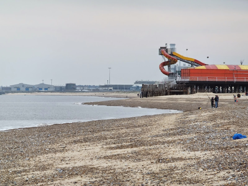
This walk is probably the most aesthetic way to approach Great Yarmouth. The beach curves round with the coast line and the wind turbine at Lowestoft is distinctively visible in the distance. This part of the beach is far from the road and other than a couple of fishermen, is deserted of people. The height of the beach shields all views of Great Yarmouth until the final yards to the pier. I know that a lot of people are fond of this in-your-face British seaside resort, having been brought up with family holidays to the place. This was the typical British holiday of the 1970s complete with kiss-me-quick hats and fairground rides and donkey rides and golden sands and walks along the prom. I grew up in Northamptonshire and just about everybody went to Yarmouth in the summer, apart from me. My family would holiday at more tranquil locations, the likes of Waxham and the Runtons and Kessingland, far from the maddening crowds. I was 19 years old before I first visited Yarmouth and all I can remember of the daytrip was the awful beer, which was Whitbread in them days, that tasted distinctly salty.
The walk ends at the Bus station. On this occasion we was fortunate enough to witness Great Yarmouth's very own eccentric Puppet Man. His unique brand of busking consists of dancing with a range of hand held puppets whilst singing along to popular songs played on a portable music player. Real name David Perry, this renowned performer has been bringing his individual brand of entertainment to the streets of both Norwich and Yarmouth since the mid 1990's. He is a sight to behold and can be seen in various youtube clips including http://youtu.be/2Mf8qjCRrlc and http://youtu.be/FGvjrDratTQ. He even has a wikipedia page dedicated to him. Legend!

Directions
Beach walk throughout
The beach is accessed at Winterton by following Beach Road. There are access points to the towns and villages that sit atop the cliffs on the route through to Caister. The end of the walk is at the Britannia Pier in Great Yarmouth.
Pubs
California Tavern, California View in OS Map | View in Google Map

- Address
- California Road, California
- Website
- https://www.californiatavern.co.uk/
The name of locality of California, which the Tavern serves, is curious in the fact that it is a modern name. The Norfolk coast in the early 19th century was the area that so called Beach Companies operated. These enterprises were set up to salvage the many vessels that came to grief on the numerous sandbanks that lay hidden beneath the waves, providing a dangerous hazard to shipping.
It was a group of beachmen from Winterton who, on May 11th, 1848 found a hoard of sixteenth century gold coins the foot of the cliffs near Scratby. The discovery coincided with the great California Gold Rush which was the current topic in the newspapers of the time and the name of California was adopted as the name for the location where the coins were found. This point along the coast gave the advantage of views of the sandbanks as far away as Corton in the south and Happisburgh in the north and a lookout was set up on top of the California cliffs, followed by houses and by 1870 a pub which received the name of The California Tavern
The original California Tavern went into the sea along with the lookout in the 1880s following cliff erosion. With this loss the California beach companies migrated down to Caister and California became a tourist haven fed by the railways.
Free house providing a range of ales including Woodfordes. Pub food, beer garden and live music.
Being out of the holiday season the pub was very quiet on this occasion. It is not often one sees the Woodfordes Mardlers mild on offer so on seeing it on tap at the tavern it would have been rude not to have tried it. A fulfilling dark mild. The drink mmet all expectations which was accompanied by large cheese and onion baguettes. A perfect pub lunch.
Never Turn Back, Caister On Sea View in OS Map | View in Google Map
- Address
- Manor Road, Caister On Sea
The pub was built in 1957 to replace the Manor House Hotel which was taken by the sea in the late 1940's and is located just off the beach at Caister. The pub sign is easily visible for those walking the beaach.
The name 'Never Turn Back' is a reference to the motto of the Caister lifeboat which was adopted after a tragedy in 1901. In November of that year a fierce storm was raging and a distress flare had been fired from a fishing smack out at sea. In answering the call, the lifeboat capsized with the loss of nine of the crew. At the inquest, one of the survivors, former coxswain James Hayletts, was asked why they had risked their lives in such conditions to which he replied 'Caister lifeboatmen never turn back' which was shorted by reporters to 'Caister men never turn back'. The irony of the tragedy was that the flare was not a distress signal at all but the skipper foolishly using it for light when the boats lights had gone out.
The pub is an ex Lacons establishment with the ceramic falcon logo still in place on the exterior of the building. Pub food available and guest ales on offer
This was at the end of the lunchtime period and the pub was very quiet. On this occasion only the Marstons Pedigree was on offer and a good example of this traditional English bitter

Features
The Devils SeatView in OS Map | View in Google Map
It was at Caister that a large sperm whale was washed ashore in 1582. This was such a huge animal that the skull was taken from the corpse and fashioned into a chair which became known as The Whalebone Seat. This was placed outside St Nicholas' church in Great Yarmouth, by the guildhall where the church gates now stand. For reasons not explained and are probably lost to history, the seat took on a more sinister aspect and was referred to as The Devil's Seat. It was said that anyone who sat in it would court disaster.
The guildhall was demolished in 1849 and the seat was moved to a location within the church by the west door. Once again, there is no clear definition as to the whys and wherefores but the chair's superstitions had changed and now it was said that after a wedding, the first to sit in the seat out of the bride and groom would be destined to rule the home.
Unfortunately the church was bombed during WWII and the seat was thought to have been destroyed with it. However, according to Volume 5 of the Transactions of the Suffolk Natural History Society', a note states that, although somewhat burnt, the parish clerk had rescued it. If this is true then maybe it still exists in a house within Great Yarmouth.
References
Winterton LighthouseView in OS Map | View in Google Map
The first lighthouse to be constructed at Winterton was built in 1618 but was then destroyed by fire to be replaced by an octagonal tower. Trinity house acquired the lighthouse in 1836 and since then it has been used as a military lookout post during WWI and then as a private residence in 1921 when its operations finally ceased. During the 1970s it was bought by the Hermanus holiday complex but has since returned to private ownership.
The tower sits atop the cliff behind the dunes that make up the area known as The Valley. A lantern structure was added to the upper observation room in 2012 which gives it a more lighthouse appearance.
References
Links and Bibliography:
Gallery
Below are a selection of images taken from from the photo album for this walk. Feel free to browse through these or click on an image to view a larger version in the Gallery.


Summary of Document Changes
Last Updated: 2021-12-07
Beach Walk, Coast Walk, Distance:Medium, Features:Folklore, Features:Lighthouses, full-detail, Norfolk, Norfolk Coast Path, OSmap:OL40


0 comments:
Post a Comment