Seals, sea and sand at Horsey Gap
|
Friday 11 January 2019
|
No comments |
![]()

A 15 mile circular walk along the Norfolk Coast between Happisburgh and Horsey Gap to witness the Seals
This section of Norfolk's east coast is dependant upon time and tide so one needs to plan it well. At low tide there are vast sandy stretches all the way through to Horsey with such delights as witnessing seals sunning themselves on the beach, a sight one cannot fail to be impressed with. Whole colonies lay on the beach and each and every one of them appears to have a photogenic aptitude. With the advent of the England Coast Path, there is a route all the way back through the dunes or on the landward side of them.
Seals, sea and sand at Horsey Gap - Essential Information
Walk Statistics:
- Start location: Happisburgh
- Distance: miles ( km)
- Total Gain: ft ( metre)
- Total Descent: ft ( metre)
- Min Height: ft ( metre)
- Max Height: ft ( metre)
- Walk Time:
- Walk type: Circular
- Walk Grade: Easy
- Terrain:
Maps:
The following maps and services can assist in navigating this route. There are links to printed maps and links to downloadable GPX route data for importing into navigational software and apps.
- Ordnance Survey Explorer Map
- OS Explorer OL40 - The Broads
- GPX Route File
Route Verification Details
- Date of Walk: 2018-07-12
- Walk Time: 11:00 to 18:30
- Walkers: Griffmonster, Kat
- Weather Conditions: Warm day, high clouds with some sunshine and a light shower later in the day
Walk Notes
The coast along this section of Norfolk is susceptible to erosion as evidenced by Happisburgh where the seafront houses have all been lost to the sea in recent times. One only has to gaze from the top of the cliffs betwen Happisburgh and Eccles to realize that there is not much between the sea and Broadland and it would not take much to have devastating consequences. So much has been lost here. Beach Road that leads to the car park then ends at the cliff top used to bend around and follow the cliffs through to Cart Gap. This is now long gone.
Further south are the stone reefs that have been added to help protect the coast and it is true that the beaches have been built up around this area although many locals contest that this is to the detriment of beaches further south. At the point where the beach extends out to the first reef is the location of the former St Marys church of Eccles. The parish of Eccles is all lost to the sea although there is the Bush Estate, a pre war holiday retreat that has become a permanent residence for many in more recent times, and is known as Eccles-on-Sea. In reality the estate is in Hempstead parish and the name is merely a reference to the long lost village.
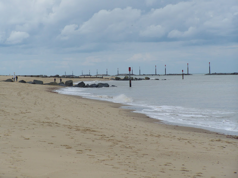
Beyond Sea Palling and the southern most reef, which is almost at Waxham, one may start to see the evidence of seals. A bobbing face sticking out of the waters then disappearing as if playing tricks on ones sight. At every photo opportunity the creature will inadvertently dive from view then reappear some distance down the water almost laughing at the hapless photographer. Ahead one may sea rocks. Grey defence rocks. But no ordinary defence rocks. As one gets closer it it soon emerges that these rocks and not rocks at all but seals, lounging around on the sand, stationary and grey and doing some expert imitations of rocks. Hundreds of them, at times. Lolling around and completely unperturbed by the wandering walkers that pass them by. Point a camera at these and they turn on their backs and pose, or even offer a sort of smile for the shot. They are mesmerising and a beautiful scene to witness. One does not have to be a wildlife enthusiast to appreciate the natural wonder of these beasts. I can guarantee that everyone who passes them are simply knocked out by the sight.
It should be noted that during the winter months (November to January) there is aa voluntary beach closure to allow the privacy for the seals during their pupping season.
It can be difficult to determine Horsey Gap, the gap in the dunes that leads to the car park. Each gap looks the same and one becomes lost in the constancy of the dunes. To be technical Horsey Gap is just under 2.5 miles from the last reef so if one allows 20 minutes walking one should be there. However I am certain anyone who walks this section will completely forget timing their walk and spend a lot longer admiring the wildlife. This shouldn't matter too much as all the gaps will lead onto the dune access back.
Return is via the paths that run along the dunes or on the landward side of the dunes. Access has been greatly improve in recent years with the advent of the England Coast Path. Prior to this there were sections such as that between Waxham and Sea Palling where the walker had to negotiate a trek along the coast road.

Directions
From the Car Park at Happisburgh follow the signs for the coast path and the ramp down to the beach. One then needs to keep to the beach and concrete defence banks all the way through to Horsey Gap. The large stone defence reefs mark the start of Sea Palling with the with the gap through the dunes between the 4th and 5th being the access into the village. From the last reef one needs to walk just under 2.5 miles to reach Horsey Gap.
Return uses the England Coast path that leads through the dunes and on the landward side. North of Sea Palling keep to the alternative path for the Coast Path which leads along the lane on the landward side of the dunes through to Eccles on Sea, rejoinging the main Coast route for the final section along the cliffs back to Happisburgh.

Pubs
Old Hall Inn, Sea Palling View in OS Map | View in Google Map

- Address
- Old Hall Inn, Sea Palling
- Website
- www.seapalling.com/old_hall_inn.html
This traditional Inn, formerly a farmhouse, dates back to the middle of the 17th century and retains its heritage both outside and within. It features two bars and a garden and serves a wide range of food from its A la Carte menu. Accommodation is available. Ales include Woodfordes and Adnams.
It is said that the pub is haunted by a figure of a woman in grey clothing sitting on a window ledge in the television lounge. From time to time an inexplicable bluish shadow has also appeared and there has been the smell of strong tobacco. During 1975 and 1976 a team of researchers investigated the haunting. They spent many hours recording some interesting material, using sophisticated detecting apparatus and arrived at the conclusion that genuine phenomena had probably occurred.
A good pint of Woodfordes Wherry.
Features
Sea PallingView in OS Map | View in Google Map
The Domesday Book records that Palling comprised 9 villagers and 14 smallholders. However this part of the coast has always been at the mercy of the sea. The town of Waxham Parva disappeared under the waves together with its church and the large estate of Gelham Hall. One of the earliest written accounts was by John of Oxendes, a monk at nearby St Benet's Abbey, in which he relates the destruction wrought by the great storm of 1287 "...the sea, agitated by the violence of the wind, burst through its accustomed limits, occupying towns, fields and other places adjacent to the coast ... it suffocated or drowned men and women sleeping in their beds, with infants in their cradles ... and it tore up houses from their foundations, with all they contained and threw them into the sea with irrevocable damage". Since this time incursions have occurred in 1604 when Eccles lost 66 houses and over 1,000 acres of land and in 1607, 1655 and 1741 when Palling's defences were breached. In more recent times, The North Sea flood of 1953 took the lives of 7 villagers. Sea defences started in the 19th century and more recently the sea wall was extended in 1986 and in 1995 the Environment Agency undertook a multi-million pound project erecting nine barrier reefs.
Smuggling was rife along this part of the coast in the 1700's when revenue cutters patrolled the coast and there were seizures of tea, Geneva (an old word for gin) and other spirits. To counter this a Coastguard service was established in 1822 and a station built at Palling. Alongside smuggling there was also salvage work. Local fishermen became organised into companies and bought themselves fast sailing yawls. There were two beach companies based at Palling, known locally as the Blues and the Whites. It was a perilous occupation and the demands for exorbitant payments may be excusable given the dangers involved. The companies prospered with the increase in maritime shipping and by 1838 had brick built sheds for storage and a lookout built to watch over the Happisburgh Sands.
References

Gallery
Below are a selection of images taken from from the photo album for this walk. Feel free to browse through these or click on an image to view a larger version in the Gallery.
Summary of Document Changes
Last Updated: 2021-12-07
Circular Walk, Coast Walk, Distance:long, Features:Local History, Features:Wildlife, full-detail, Norfolk, Norfolk Coast Path, OSmap:OL40


0 comments:
Post a Comment