The Essex Coast - Salcott to Tollesbury
|
Tuesday 22 February 2022
|
No comments |
![]()

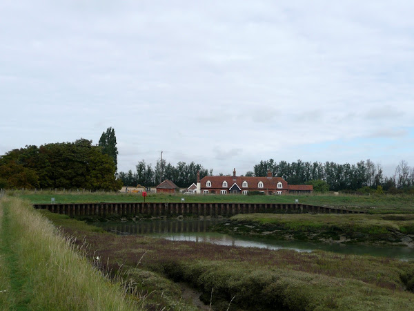
Salcott to Tollesbury
The sixth stage of a weeks walking along the Essex Coast between Manningtree and Maldon.
NOTE
This is a walk summary intended to provide the user with just the essential information in order to navigate the walk route. Fully detailed information notes, refreshment stops and walk features are not included in this. A full write up will be included in the near future.
Salcott to Tollesbury - Essential Information
Walk Statistics (calculated from GPX):
- Start location: Salcott
- End location: Tollesbury
- Distance: miles ( km)
- Total Gain: ft ( metre)
- Total Descent: ft ( metre)
- Min Height: ft ( metre)
- Max Height: ft ( metre)
- Walk Time:
- Walk Grade: Easy
- Terrain: Footpath, Country Lane, Road
Maps:
The following maps and services can assist in navigating this route. There are links to printed maps and links to downloadable GPX route data for importing into navigational software and apps.
- Ordnance Survey Explorer Map
- OS Explorer 184 - Colchester
- GPX Route File
Route Verification Details
- Date of Walk: 11/09/2010
- Walk Time: 10:30:00 to 13:00:00
- Walkers: Griff, Kat
- Weather Conditions: morning was overcast, but the afternoon was warm sunshine and blue skies
Walk Notes
Route: From the Woodrolfe car park walk back into the village and turn right opposite the square down Station Road. This soon becomes a track and a footpath leads off to the left, follow this through to where the hedgerow ends and a path cuts across to the sea defences. Follow the defences around Old Hall Creek. From here it is possible to circumnavigate the whole of Old Hall Marshes but we took the track at Old Hall Farm which comes out on the north side of the marshes at Salcott Channel. Follow the sea defences once again to the left until a footpath leads into Salcott village. Return is from a footpath in the centre of the village which leads a virtually straight line across the fields and onto the Tollesbury road which leads back to the village square. Return to the car park and continue along the road to Tollesbury Marina. Keep to the waters edge and this will lead out around Tollesbury Wick with magnificent views of Tollesbury Fleet and Mersea Island. Return is via a footpath just beyond Mill Point on the south side of the marshes.
Pub: The Kings Head, Tollesbury: the only remaining pub in the village which once boasted a total of six. A friendly place with a group of locals discussing the local gossip. Nice selection of guest ales. I tried a pint of welsh ale from a brewery whose name on the beer pump was Bragdy Mŵs Piws Cyf - I am led to believe this is welsh for Purple Moose Brewery Ltd. The beer was most excellent and refreshing.
Walk Feature: The old Crab & Winkle line: (http://www.tollesbury.org/history/crab_winkle.html) Tollesbury was once had a railway that linked to the main rail line at Kelvedon Navy. The line became known locally as The Crab and Winkle Line and was opened in 1904. An extension through the marshes to a pier which extended 600 yards out into the Blackwater. Eventually the line closed in 1951.
Walk Feature: Tollesbury Wick Nature Reserve: This 600 acre site is a rare example of an Essex fresh water grazing marsh, worked for decades by traditional methods sympathetic to wildlife.
Notes: The grass around most of Tollesbury Wick was freshly cut and as we started walking along the southerly side we met up with the chap who was cutting it. He had a small tractor type vehicle which he was using to cut a 10 yard width at the bottom of the sea defence as well as the grass slope and the top. He stopped to chat with us for 15 minutes, telling us that he had mowed the grass all the way from Heybridge basin, which was good to know. Although long grass on sea defences does not provide much of an obstacle it does hold dew and dampness and I have had a few occasions where I ended up with soaked boots and trousers after walking through uncut grass on sea defences in Norfolk and Suffolk. So this was good to know that our walk through to Maldon the next day should be easy.
Accommodation: Grange Farm Camp Site, Thorpe-le-Soken - an excellent and recommended site with basic facilities and friendly staff. It is close to the railway station and has a resident owl.
Transport: Although Heddingham Coaches provide services to Colchester, Maldon and Witham, these only run every two hours with no late services and it would have been difficult to get public transport all the way from Thorpe and back and still leave enough walking time. Therefore we drove to Tollesbury and parked in Woodrolfe car park (free)
Summary of Document Changes
Last Updated: 2022-02-22
Images


Coast Walk, Distance:long, Essex, Essex Coast Walk, Features:Nature Reserve, Features:Railway Heritage, OSmap:184, summary


0 comments:
Post a Comment